The models continue to show a major storm system impacting the Carolinas this weekend, so that means our winter weather threat continues to increase.
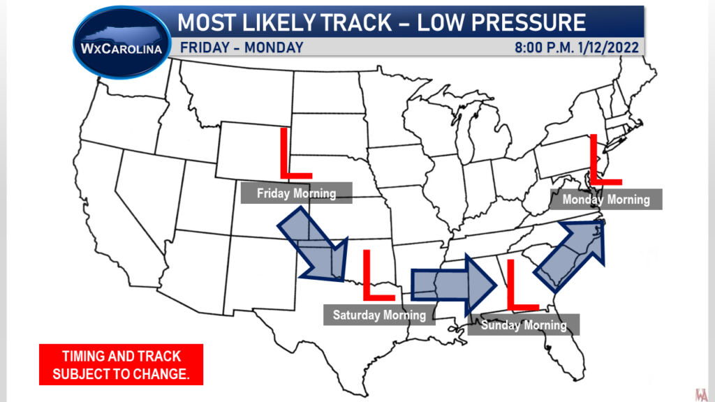
Throughout the day, models remained in good agreement overall with the evolution of our system with just minor changes with the track. As always, these minor changes to impact the final forecast, but overall, the models have remained relatively consistent with this forecast. One of the changes was the strength and speed of the system. It appears the system is going to be a little stronger than originally thought, and it appears the system will move a little slower than thought. The track has also shifted a little further west towards the Carolina coast. I now expect the system to ride along the coastline, which pushes the rain/snow line a little further west.
It still remains too early to determine which precipitation types will fall where. Right now, this has the look and feel of a very typical winter storm coming from the Gulf of Mexico. Western NC has the best chance for snow for the majority of the event, with some sleet possible outside the highest elevations. Central NC would be a battle zone with all kinds of weather from snow, sleet, freezing rain, and rain. Eastern NC would have mainly rain as the low moves through, but some snow and sleet is possible before the warm air moves in.
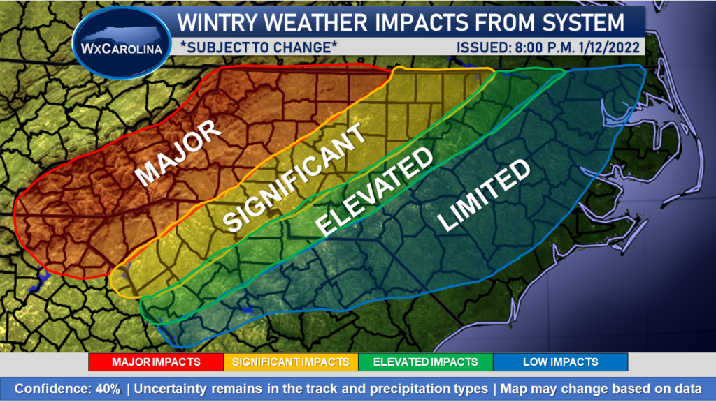
That is why I have a MAJOR IMPACT across western NC. This area has the best chance to see the greatest impacts in terms of wintry weather from this system. The I-85 area stretching through central NC is the battle zone, so there is a broad area of significant and elevated risk. These areas will probably be narrowed as we get closer to the system and get a better idea of the track. Eastern NC may see limited impacts, especially at the onset of the system and possibly on the backside of the system.
The confidence in the impacts is 40% due to the uncertainty in the track of the system, which leads to uncertainty in the precipitation types. This map may change based on additional data.
I was hoping to be able to post a first accumulation map Thursday evening, but it depends on the models continuing to come into better agreement. With the snow/sleet/ice/rain line uncertainty, the accumulation map confidence remains too low to post.
Be sure to continue to check on my Facebook page or my website for the latest information. I will keep you updated with the latest changes.
