Confidence has increased this morning that a winter storm containing snow, sleet, and cold rain is expected to impact our area on Thursday and Friday.
A front stalled to our south will interact with energy from the west developing an area of low pressure across the deep south. This low is expected to transfer energy to the coast, allowing for rain to develop outside the mountains. In the mountains, this event is expected to be nearly all snow.
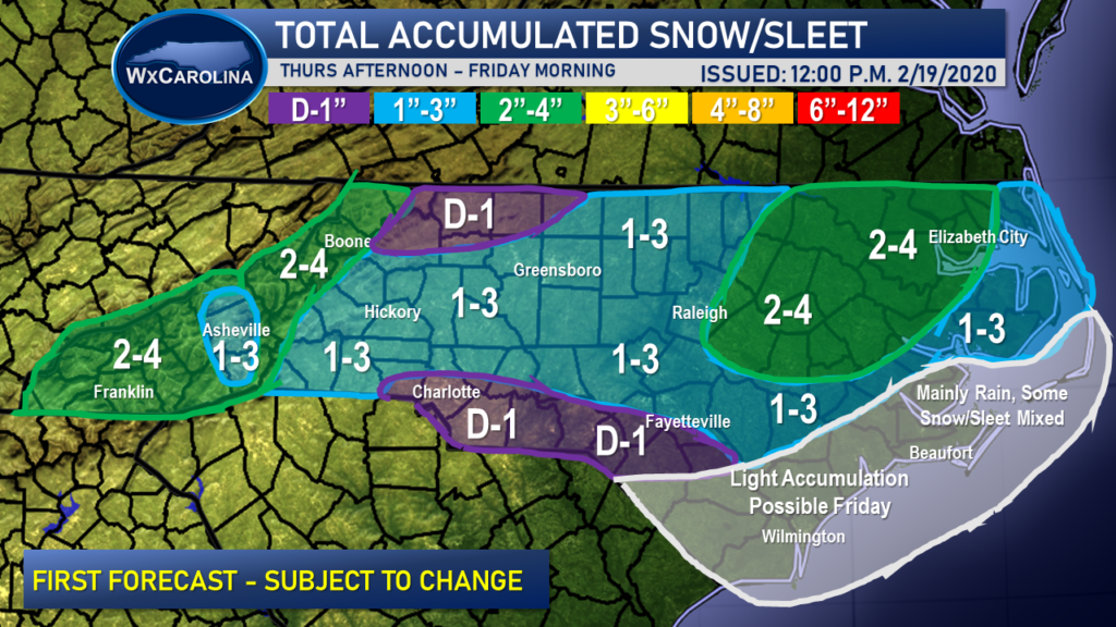
During the afternoon hours, a transition from rain to snow is expected outside the mountains, and many areas from the foothills to the coastal areas are expected to see accumulating snow from this system. My first accumulation forecast map has been issued, and it shows the highest snow totals in the mountains and in eastern NC. In eastern NC, this area will be closer to the low pressure, which should allow for more moisture to move in.
The forecast certainty remains low due to the overall progression of the system, the amount of moisture, and general model uncertainty. Therefore, I will be issuing forecast updates throughout the evening and during the morning tomorrow.
