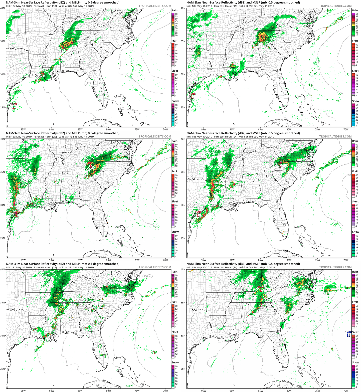
Mother’s Day Weekend is looking stormy across the Carolinas with numerous showers and storms on Saturday with another round of afternoon storms on Sunday.
A cold front will stall across the mountains this weekend, waiting for an upper level disturbance to push it to the east on Monday. Before this happens, periods of heavy rain is expected across the Carolinas.
Showers and storms are expected to begin in the morning across the mountains, foothills, and piedmont of NC and last through the evening hours. Models indicate 2-3 rounds of showers and storms on Saturday with the very unstable airmass and elevated levels of moisture.

The High Resolution NAM computer model from midnight Saturday through midnight Sunday shows the showers and storms. The best chance for a line of strong to severe storms will start in the mountains during the morning hours, pushing eastward into the piedmont during the afternoon.
Severe weather is possible, but not likely. The greatest threat would be damaging wind gusts.
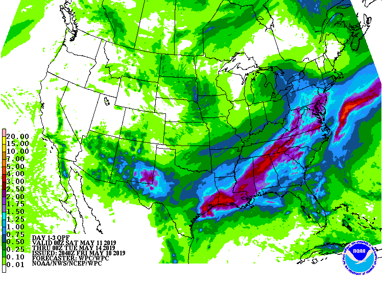
The greatest threat will be flash flooding due to very heavy rain. Over the next 3 days, 2-3 inches of rain is expected in the mountains, with 1-2 inches of rain expected for many areas outside the mountains. Higher amounts are likely where the heaviest thunderstorms develop. I would not be shocked if some areas in the mountains and foothills see over 4 inches of rain this weekend.

The weather is expected to improve behind the frontal passage on Monday, with cooler temperatures and lower humidity expected next week.
