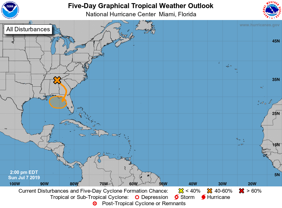
An upper level disturbance in the southeast United States is causing numerous showers and storms; however, this disturbance needs to be monitored for tropical development later this week.

This area of disorganized showers and storms is currently located over Tennessee and is expected to drift southward over the next 48-72 hours. Models are currently taking this piece of energy into the northern Gulf of Mexico during the mid week time frame. Any development would be during the mid week or the end of the week.
Water temperatures in the Gulf of Mexico are very warm, which is supportive of tropical development. Upper level wind shear is also low, which may allow this area of energy to develop into a tropical cyclone.
At the moment, the National Hurricane Center gives this low pressure a 50% chance of developing into a tropical cyclone. I will continue to monitor this situation and will keep you updated with the latest changes in the forecast.
