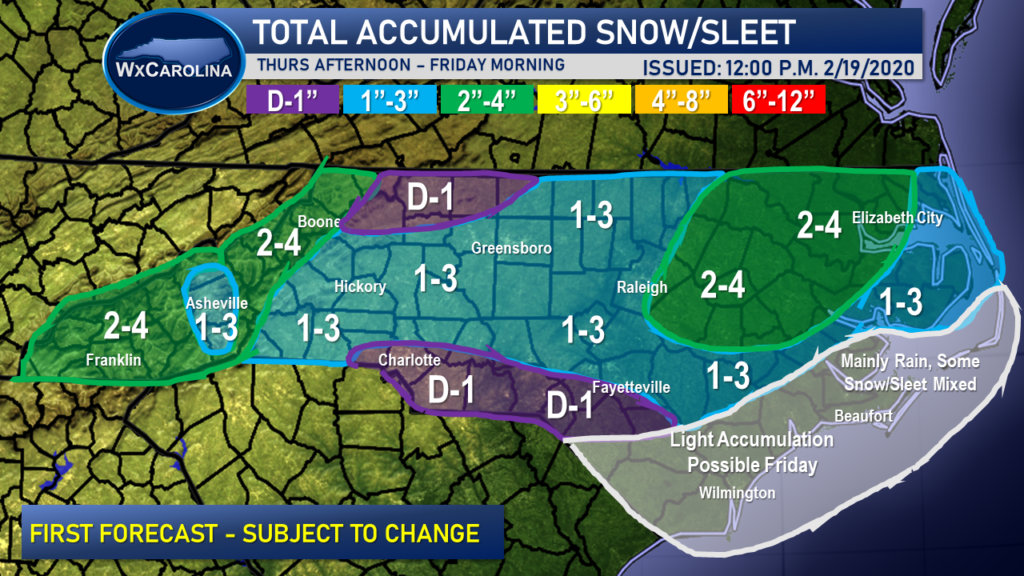
A winter storm is expected to impact our area on Thursday and Friday, and accumulating snow is expected.
The snow is expected to begin in the mountains before pushing eastward into the foothills around lunch. Piedmont locations may start as rain before quickly transitioning to snow during the evening hours. Snow is expected to continue into the overnight hours, especially in eastern NC. By Friday morning, the snow is expected to be coming to an end and drying conditions are expected. Friday morning may feature travel issues due to black ice when temperatures drop below freezing.

The snow accumulation forecast is difficult because temperatures are expected to remain slightly above freezing during a majority of the event. Therefore, the snow is expected to melt on contact. Regardless, the snow may stick to roads during heavy bands, so the evening commute may be affected by the snow.
As always, I am continuing to monitor the situation and will keep you updated with the latest information.
