It seems like we are in a pattern where it rains every Friday. It should not come as a surprise that rain is in the forecast again this Friday. A potent upper level trough is expected to move into the Carolinas on Friday and has the chance to bring very heavy rain and severe weather.

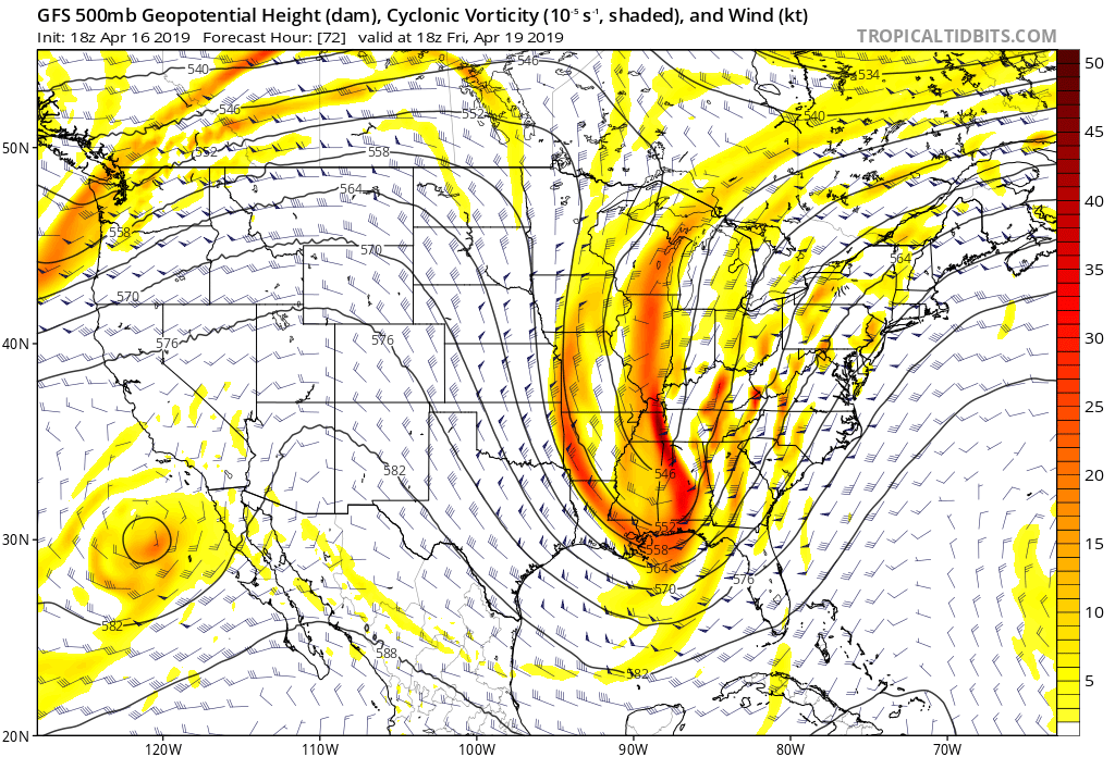
The 500mb map shows the strength of this upper level disturbance. Notice how the upper level low stretches from the Gulf of Mexico all the way to the Great Lakes. This will allow copious amounts of moisture to push northward into the Deep South.

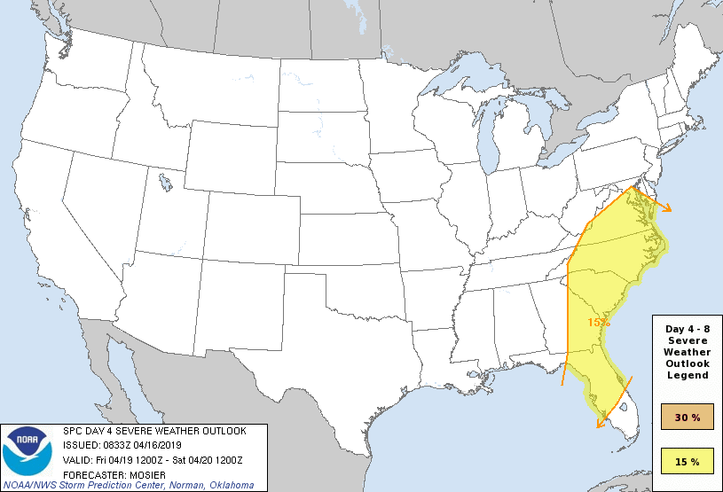
This warm tropical air is expected to interact with the cooler air from the north, which could lead to severe storms on Friday across the East Coast. The Storm Prediction Center shows a chance of severe weather next week. It is way too early to determine the timing of the severe weather and the greatest threats; however, damaging winds would more than likely be the greatest threat.
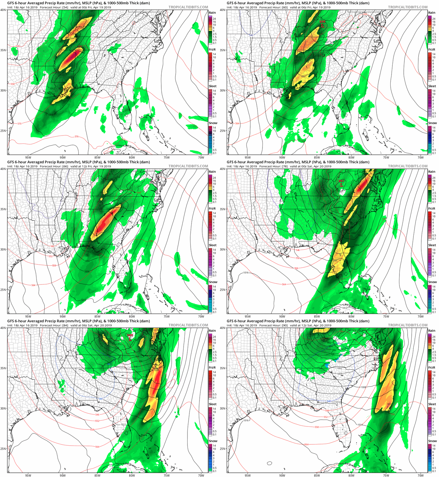
While the timing may change, the system is expected to enter the mountains during the morning hours on Friday. It moves eastward into the piedmont during the afternoon hours before moving east early Saturday morning. The images below show the progression of this system from Thursday evening into Saturday morning.

As the system departs, some computer models keep the upper level low over the western portions of NC on Saturday. This may allow for isolated showers across the foothills and piedmont, with a few rain/snow showers in the mountains. Yes, snow in middle April is possible this weekend in the mountains. The highest peaks may see minor accumulations.
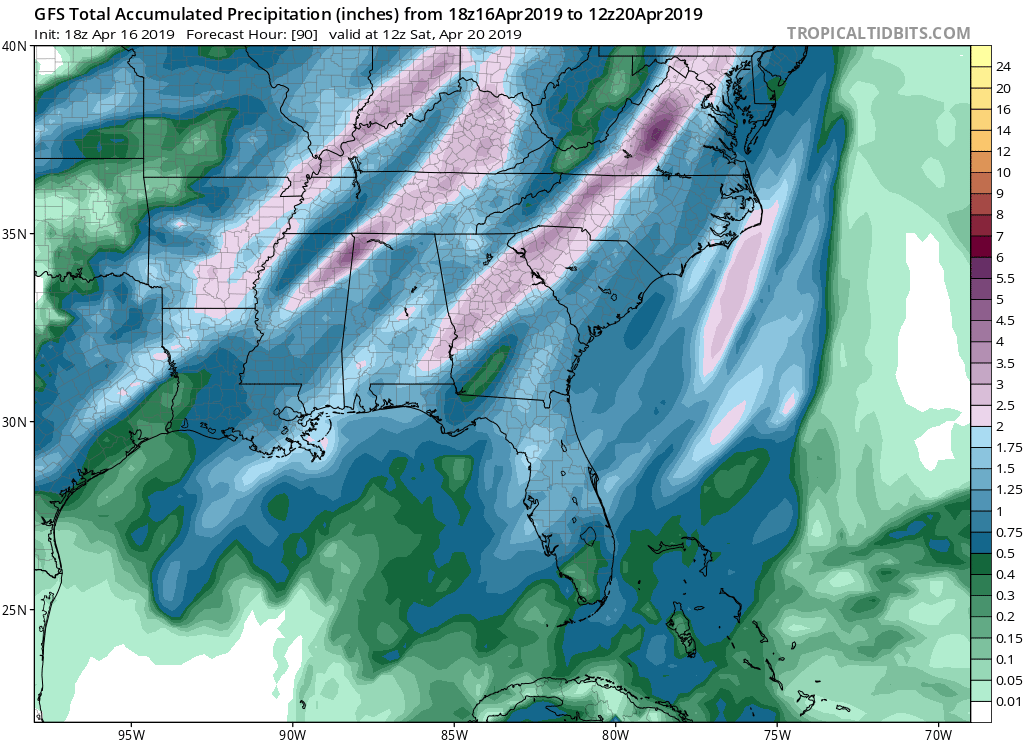
Flash flooding may become an issue with the amount of moisture moving northward with this system. Moisture levels will be well above normal, and these showers and storms have the potential to produce very heavy rain. It appears most areas will see 1-2 inches of rain through Saturday morning. A few areas in western NC may see higher amounts.

I will continue to monitor this system and will keep you updated with the latest information and changes in the forecast.
