Another round of wintry weather is expected Friday and Saturday in the Carolinas, but this time, it is expected to be across eastern NC instead of western NC.
A front is expected to pass on Thursday, bringing colder air behind it. While the front passes, some of the moisture may change from rain to a snow/sleet mix as cold air rushes in. Accumulations Thursday would be very very light.
Instead of moving into the Atlantic and away from the Carolinas, the front is expected to stall near the coast and allow a weak area of low pressure to move along it. This, coupled with good upper level energy, should allow a period of snow, sleet, and freezing rain for much of eastern NC Friday morning through Saturday morning.
All kinds of precipitation are possible during this event across eastern NC. The EURO computer model (image below) shows the general timing and what kind of precipitation it is predicting for this event.
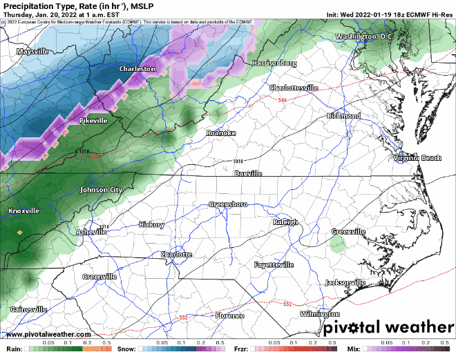
As you can see above, the EURO brings a good deal of moisture inland before it pulls the coastal low away. There is still some uncertainty in the models, mainly based on where the front stalls and where the low tracks. Therefore, the forecast may change.
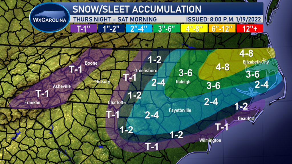
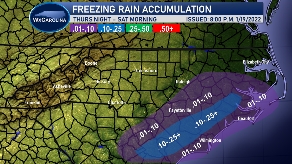
Below is the accumulation map. As you can see I expect northeastern NC to do very well from this storm with some areas picking up 4-8 inches of snow. Raleigh area I expect 3-6 inches of snow, and lower amounts as you head west. The ice may also be an issue across southern NC with the slow moving nature of this storm. Power outages will be possible.
I will keep you updated on the latest trends in the models and the forecast on my Facebook page, WxJordan.
