Many on social media have been getting excited about the possibility of another winter storm for the Carolinas this weekend., but there is a lot of uncertainty and the likelihood of a winter storm is not very good.
While the pattern remains favorable for wintry weather, it appears the storm system this weekend is going to have a difficult time producing much wintry weather across the Carolinas. Right now, models are in good agreement that a front will pass through the Carolinas on Friday or Saturday, and interact with an area of low pressure off the coast. As the energy moves into the coast, all models agree that a major storm develops and moves northward into the northeast.
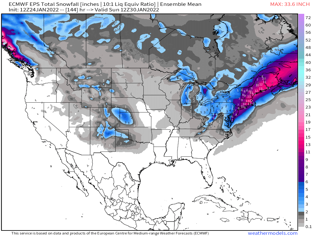
As of right now, there is relatively good agreement there will be a major winter storm in the northeast this weekend. But, for us, models are showing just a slight chance at some wintry weather Friday into Saturday. The image below shows the accumulated snowfall on the EURO Ensembles, and notice the larger snow totals are across the northeast United States. This is where there is better agreement among Ensemble members of very high snow accumulations this weekend.
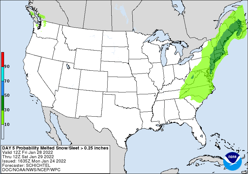
As always, there is still some uncertainty with the overall forecast and there is time for this to move a little further south. Right now, the best chance to see accumulating snow would be in northeast NC because you will be closer to the expected low track. The NWS has most of the Carolinas in a slight chance of receiving snow this weekend (see image below).
As always, I will keep you updated with the latest model trends and as the forecast becomes more clear, I will keep you updated.
