Portions of the Carolinas are in store for another winter storm, but this time, it may be the eastern portion of the state that sees the biggest impacts.
An Arctic cold front is expected to move across the Carolinas on Thursday, bringing another surge of below average temperatures and some light precipitation. But the front is going to slow down and even stall along the coast as it runs into a ridge of high pressure. This will allow some weak impulses to move northward along the stalled front, which may bring the chance for some wintry weather, especially to our eastern counties.
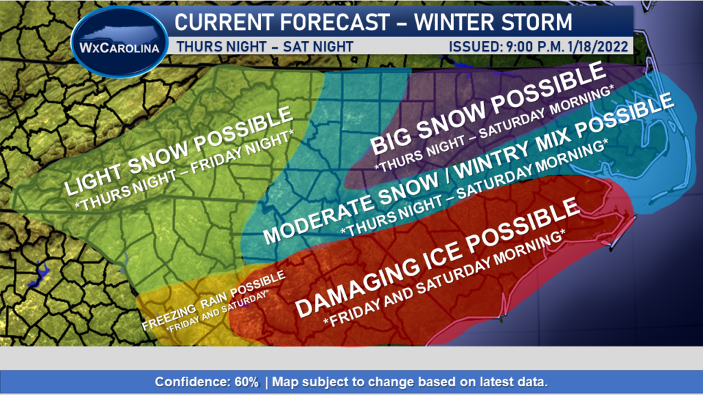
My current forecast for this system is pretty broad at the moment due to uncertainty in the models, but most of the data shows the best chance of wintry weather to be east of I-77 roughly. In matter of fact, some areas in northeast NC may see some large snow totals from this event (purple shaded). Blue areas may see moderate snow and a wintry mix from the front, while the red areas are expected to see the chance for damaging freezing rain. In the west, light freezing rain is expected in parts of South Carolina with the chance for light snow over the mountains, foothills, and western piedmont.
The timing of the event would be roughly Thursday Night through Saturday Morning, according to current data. I will be fine tuning the timing of the event as we move closer and models begin to handle the stalled front and energy more accurately.
Regardless, now is the time to make preparations across eastern NC for this event. Please make sure you have the necessary food, water, and tools needed if the power goes out. I will have more details, including accumulations, as confidence increases in the forecast.
