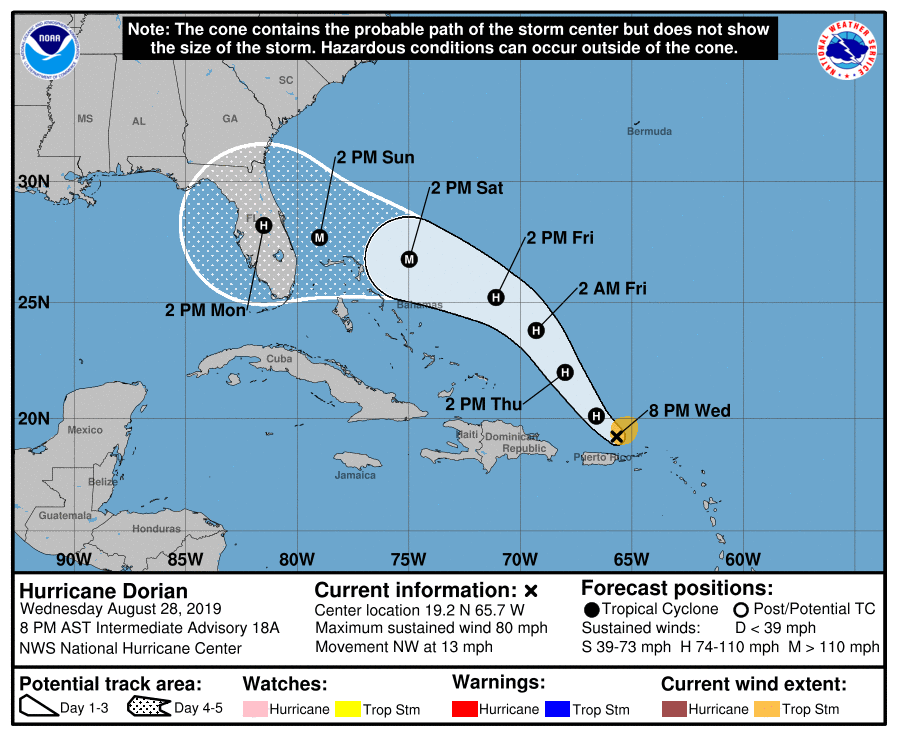
Hurricane Dorian is continuing to strengthen as it moves by Puerto Rico this evening under low wind shear and warm ocean waters. Current indications are Dorian may impact the East Coast this holiday weekend as a major hurricane.

Hurricane Dorian is a relatively small hurricane at the moment; however, an eye is starting to develop. Strengthening is expected to continue with the favorable environment.

The official track from the National Hurricane Center brings Dorian north and west over the next three days. High pressure is expected to develop north of Dorian later this week and this weekend, which is why the storm is expected to move westward this weekend. The official NHC forecast strengthens Dorian into a major hurricane.
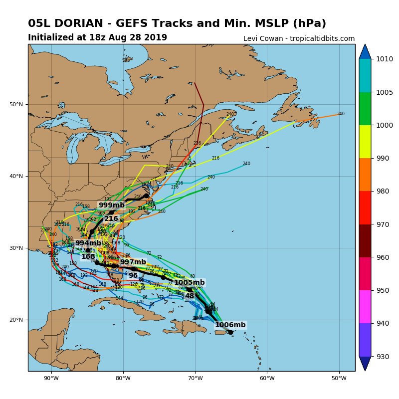
The cone of uncertainty stretches from the Georgia coastline to the Florida Keys. The average error of a 5 day forecast is 200 miles, so there is still uncertainty with Dorian. The computer models have shifted southward over the past few runs, which increases the threat for Florida. Note the images below are forecast models and are not official tracks in any way shape or form.
Regardless, the entire East Coast needs to monitor the latest forecasts with Dorian. Right now, the greatest threat remains with Florida and the Gulf of Mexico. Be making plans now, especially in Florida, for the potential for a Major Hurricane to make landfall this weekend or early next week.


