Hurricane Dorian has maintained hurricane strength, but has not strengthened much since yesterday evening due to mid level wind shear. The wind shear is expected to weaken overnight, which is expected to allow Dorian to rapidly develop overnight and tomorrow.
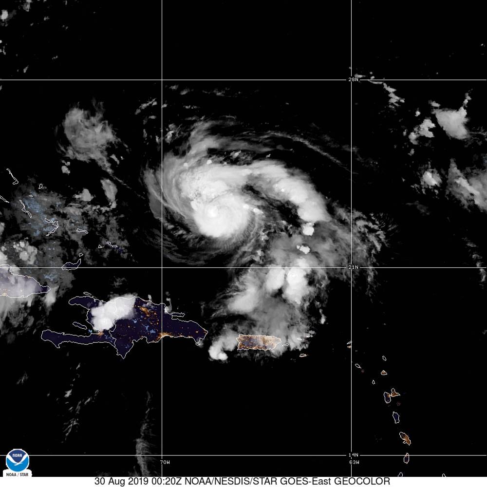
Dorian is currently packing winds of 85 mph and a central pressure of 986 mb. The pressure has dropped slightly from yesterday, indicating the storm is attempting to strengthen. Dorian is expected to strengthen on Friday into a major hurricane due to very warm sea surface temperatures and low vertical wind shear.

The National Hurricane Center forecast has not changed much from yesterday, except the latest forecast is slower than previous forecast. Dorian is expected to move northwest until turning westward as high pressure builds in from the north. On Sunday morning, you can see the ridge of high pressure north of Dorian, which is expected to steer Dorian westward towards the Florida coastline.
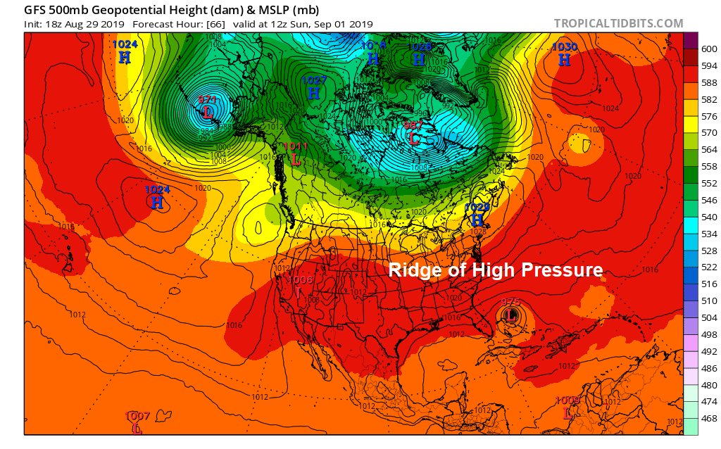
The strength of this high pressure is key to the forecast. If the high pressure is weaker, it may allow Dorian to stall before reaching the Florida coastline and move northeast. If the high pressure is at current strength, Florida may face landfall of a major hurricane. So, there is still some general uncertainty with the forecast.
The spaghetti plots indicate the uncertainty with this system below. As you can see, the models slow Dorian as it approaches the Florida coast, which may bring extended periods of hurricane conditions. Most models continue to indicate a major hurricane landfall along the Florida peninsula.

Chances continue to increase that a major hurricane will impact the coastline of Florida this Labor Day weekend or early next week. Be sure to begin making necessary arrangements for Dorian, especially across the state of Florida.
