Another large scale weather system is approaching the Carolinas, and it looks like this system will once again bring a chance of wintry weather Friday morning before transitioning to a cold rain.
Clouds will increase Thursday afternoon as the system approaches the Carolinas with moisture streaming in aloft. By very early Friday morning, light freezing rain is expected across much of the mountains and foothills of NC. The good news is this event is expected to be light with very little accumulations. Temperatures are expected to rise above freezing during the late morning hours, so any ice that does accumulate will quickly melt.
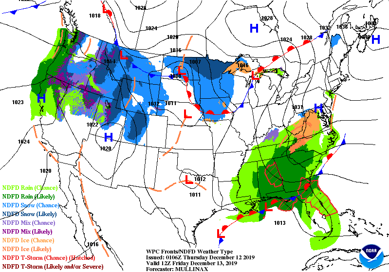
The main threat is expected to be light icing on the roads. Remember, it only takes a small amount of ice on the roads to create major hazards. If you must travel Friday morning, be sure to drive carefully across the mountains, foothills, and western piedmont of NC.
The National Weather Service in Greenville Spartanburg has most areas receiving under a tenth of an inch of freezing rain. Widespread power outages is not expected due to the light nature of the freezing rain event.

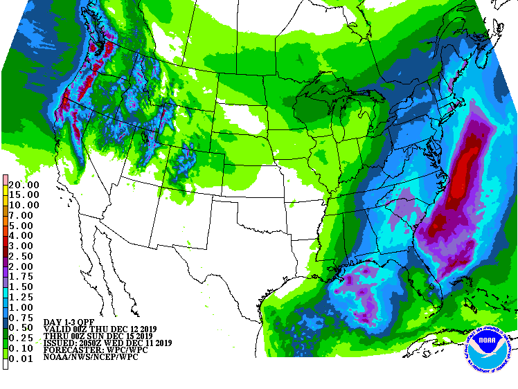
Friday Afternoon, most areas are expected to warm above freezing and transition to a cold rain. Showers are expected to continue into the morning hours on Saturday before the system departs Saturday afternoon. After all is said and done, 1-2 inches of rain is expected from this system.
Looking forward, temperatures behind the system are actually expected to remain above average. I am tracking another big system during the middle to late part of next week that has the potential to bring another round of heavy rain to the Carolinas, but we have plenty of time to track that system.
