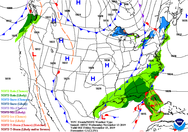
A potent coastal low is expected to bring very heavy rains and elevated surf to eastern North Carolina starting Thursday and lasting through the weekend.
An upper level disturbance is moving in from the west and it will interact with a stalled boundary along the Gulf Stream. An area of low pressure is expected to develop along this front, and the low pressure is expected to move very slowly to the northeast through the weekend.
Rain on Thursday and early Friday morning may stretch as far west as the mountain, and there may even be a few snow flurries on the far northwest side of the low pressure across the mountains and foothills. The rain chances decrease for the mountains and foothills as we enter the weekend; however, the rain chances remain elevated in central and eastern NC, especially east of I-95.
7 p.m. Thursday 
7 a.m. Friday 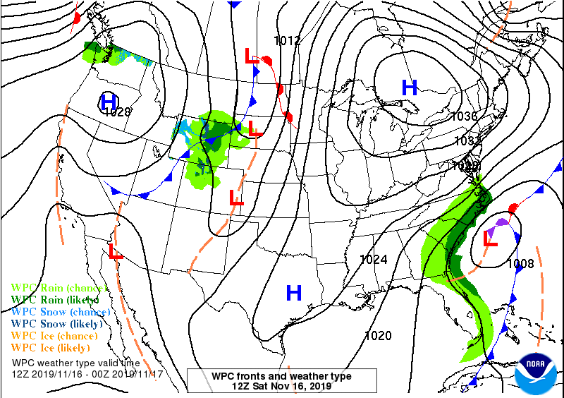
7 a.m. Saturday 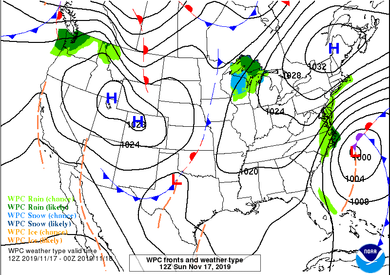
7 a.m. Sunday
As you can see, the area of low pressure is expected to push slowly to the east over the weekend. This would lead to very high rain totals along the coast and east of I-95. The Weather Prediction Center has many coastal communities receiving over 3 inches of rain before the system pulls away. I would not be shocked if some areas receive 5-6 inches of rain over the next five days.
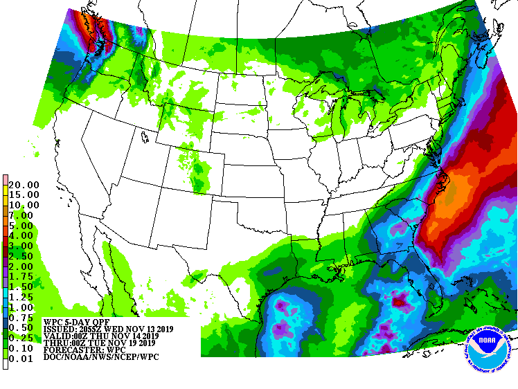
Notice the sharp cutoff across eastern NC. This cutoff depends on the track of the low pressure. If the low tracks a little further east, then the rain totals will be lower. If the low tracks a little further west, the the rain totals will be higher a little further west. A lot depends on the final track of the low pressure.
Heavy winds are also expected along the coast as the low pressure strengthens and moves slowly north and east. These heavy winds are expected to allow coastal flooding to parts of the Outer Banks this weekend and early next week.
The National Weather Service at Morehead City issued the following discussion Wednesday evening regarding coastal flooding…
As of 7 PM Wed…A complex low pressure system will impact eastern NC Friday through the weekend. Persistent, strong northerly winds could lead to moderate to potentially significant coastal flooding along the Soundside Outer Banks mainly south of Oregon Inlet, Downeast Carteret County, the Lower Neuse River, and southern shores of the Albemarle Sound and Alligator River. The most oceanside impacts, including beach erosion and ocean overwash, are expected along the Outer Banks, especially north of Cape Hatteras where portions of NC 12 could become inundated and impassible at times. Please continue to monitor the latest forecasts from the National Weather Service on this developing weather situation.
-National Weather Service Morehead City as of 7:00 p.m. 11/13/2019
The low pressure is expected to pull away on Sunday; however, I am already tracking another coastal low that may impact the weather along the coast again on Tuesday and Wednesday.
