A cold front is expected to bring accumulating snow to the mountains and valleys this week and below average temperatures from the mountains to the beaches.
The cold front is expected to enter the mountains on Tuesday morning, and the moisture is expected to start as rain. As cold air rushes in at the surface, mountain locations are expected to quickly change from rain to snow late Tuesday morning or afternoon. Accumulating snow is expected in the mountains and neighboring valleys; however, accumulations depend on elevation.
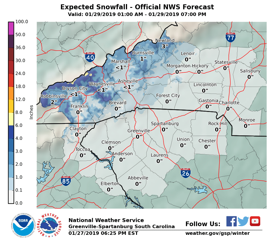
The highest elevations are expected to see 4-8 inches of snow, with valleys receiving between a dusting to 2 inches of snow. Most areas between 3000 and 5000 feet are expected to see 2-4 inches of snow before the moisture departs. The image below is from the National Weather Service, and notice how the highest snow totals are right along the boarder of NC/TN.

The cold air is expected to struggle to make it over the mountains quick enough to change the rain to snow outside the mountains. Therefore, I expect the foothills and piedmont to remain mostly rain. A few wet snowflakes are possible, but accumulations are not expected.
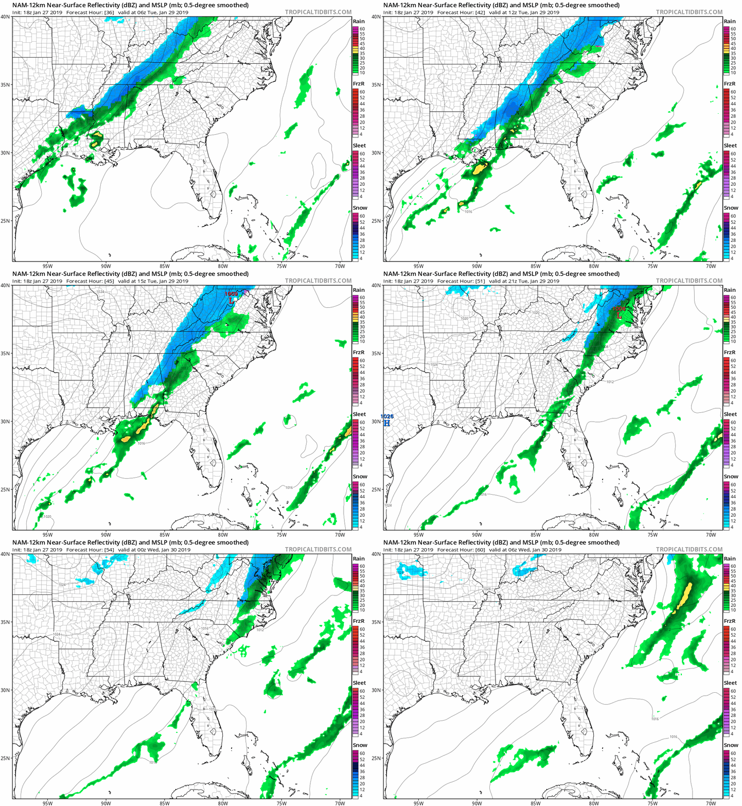
The NAM futurecast radar shows the moisture moving into the mountains Tuesday morning before exiting the coast early Wednesday morning. The NAM indicates a few wet snowflakes are possible outside the mountains.

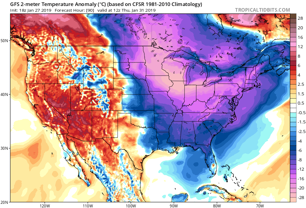
Cold air advection ramps up Wednesday and another round of cold air is expected to flood into the Carolinas. Some areas will be 15-25 degrees below average for this time of year on Wednesday and Thursday.

The good news is warmer temperatures are expected this weekend as the cold high pressure moves to the east. Additionally, it appears high pressure will be in control of our weather, which means we should have another dry Saturday before a system potentially causes issues for Sunday and Monday next week.
