A cold front on Thursday and Friday is expected to bring heavy rain to the Carolinas, with flash flooding and severe storms possible as the front passes.
The quick moving front is expected to march across the country Wednesday through Friday. We are going to be on the warm sector of the storm, and you will notice the warmer temperatures Wednesday and Thursday. Thursday, clouds are expected to increase with showers across western NC.
The main line is expected to enter the mountains Thursday Night and push eastward through the morning hours. Your morning commute is expected to feature showers and possibly a few thunderstorms. As the front pushes east, the best moisture and the best energy lifts well north of the Carolinas, so lower rainfall amounts are expected in eastern NC. By Friday afternoon, the front is expected to push off the coast and drier weather moves in.
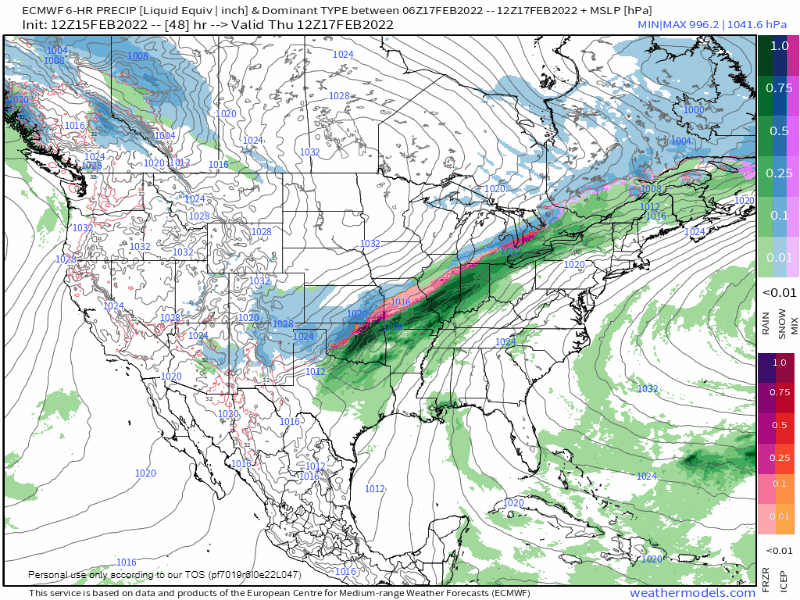
Below is the EURO computer model and it shows the progression of the system across the country through Friday Afternoon.
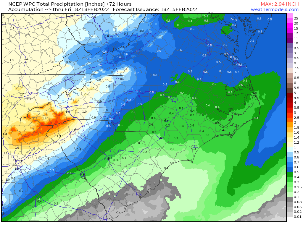
The highest rain totals with this system are expected in the mountains, where 1-2 inches of rain is likely. This area also has the threat of isolated flash flooding, but widespread flash flooding is not expected. Outside the mountains, the rain totals range from around an inch in the foothills and western piedmont to under a half of an inch in eastern NC.
Additionally, a few severe storms are possible, with the greatest threat across western and central NC late Thursday Night and Friday Morning. We are not expecting widespread severe weather at the moment. This forecast will be fine tuned as we move forward.
After the front passes, the weather for Saturday and Sunday looks great with sunny skies and seasonal temperatures.
