After 10 days of rain across much of western and central NC, a few dry days are expected before more rain moves into the Carolinas for the end of the week and the weekend.
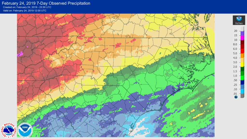
Much of western and central NC have seen 10 straight days of rain. In Asheville, over 5 inches of rain has fallen since February 15th. Charlotte has seen over 4.5 inches of rain since February 15th, and Raleigh has seen nearly 4 inches of rain over the past nine days. Some areas received 3-4 inches more precipitation than normal for mid February.
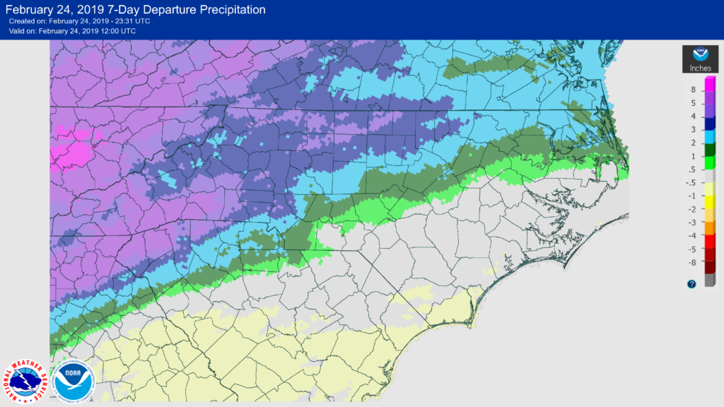
Eastern locations saw lower amounts of rain, especially south and east of I-85. A few locations in far southeast NC actually saw lower amounts of precipitation compared to normal.
On Sunday, a front brought drier air; however, wind gusts of 20-30 mph outside the mountains have caused issues with trees falling and power lost. Winds are expected to decrease on Monday and especially on Tuesday. Mostly Sunny skies are expected both days with average to above average temperatures.
By Wednesday, our next system will be approaching the area. This system is not expected to have much moisture with it, so expect a small chance of rain during the day and during the overnight hours. Rain totals are expected to be light.

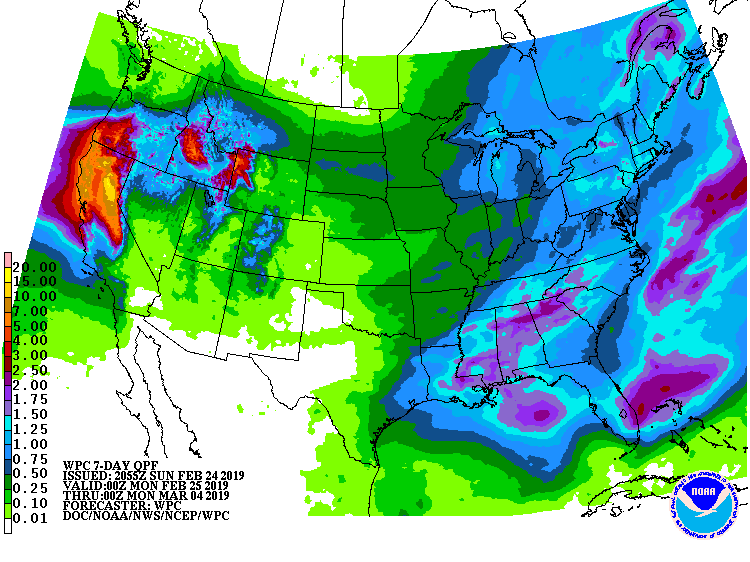
The next two systems are expected to move through the area on Friday and Saturday, and both are expected to bring more rain to the area. It is quite possible that both days are washouts. The computer models show the heavy rain moving from the mountains eastward through the piedmont and coastal areas.

The biggest difference in these systems vs. the systems this past week is the amount of rain. Models indicate that most areas will see 1-2 inches of rain from the mountains to the coast. A few places in the mountains may see 2-3 inches of rain. The image below is the 7 day precipitation forecast from the Weather Prediction Center.
Following the front on Saturday, cooler and drier air is expected to move into the southeast. Models are indicating below average temperatures are possible for the first Sunday in March.
