Our storm is set to begin in just a few hours, and the main story is going to be the amount of sleet and freezing rain. Pretty much everyone outside the mountains are expected to see ice from this system. The question remains… How much snow before the changeover occurs? The line is going to be a sharp line between a lot of snow and not much snow.
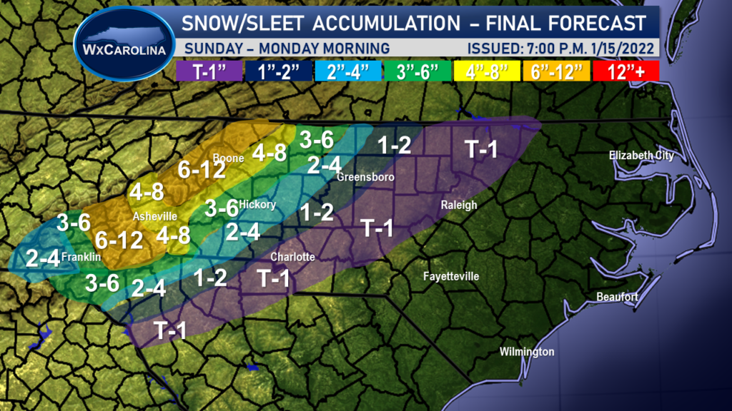
I have decreased the snow accumulations for everyone outside the mountains slightly due to the sleet mixture. It appears that most areas outside the mountains will change over before 10:00 a.m., which would keep snow totals on the lower end of the spectrum. Even some valley locations may see lower accumulations because of sleet mixing in.

I still expect north and west of 321 to see the best chance of accumulating snow before the changeover. In the Catawba Valley, I am expecting 2-4 inches to the east of 321 and 3-6 to the west of 321. For the escarpment, I am expected 4-8 inches of snow. Eastward in the triad, 1-4 inches of snow expected and in the Charlotte area, around a trace to an inch of snow expected.
