A rapidly strengthening storm system is expected to bring snow to the Carolinas Friday Night and Saturday Morning, and some areas may see accumulations.
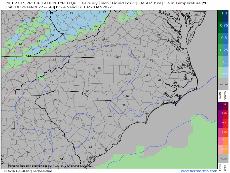
The GFS computer model shows the progression of the storm below. A front is expected to pass on Friday and behind it, cold air is expected to move in. As the upper level disturbance moves in, an area of low pressure is expected to develop and rapidly strengthen as it moves northward. This nor’easter is expected to bring blizzard conditions to portions of the northeast this weekend. The pressure drop in a 24 hour period is expected to be very high, and the system is actually part of the reason why warmer temperatures are expected as we move into February.
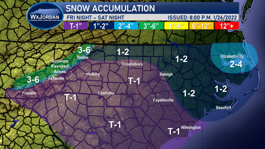
For us, the overall situation is not expected to be quiet as bad as the northeast, even though some areas are expected to see accumulating snow. The best chance is once again in northeast NC, because you are closer to the low. Additionally, the upslope favored mountains are expected to receiving 3-6 inches of snow, with higher amounts possible.
A large swath of the Carolinas are expected to see just a quick burst of flurries or a quick dusting of snow. Regardless, travel may be impacted if the snow is able to come down hard enough Friday Night and Saturday, evening in the purple shaded areas.
As with all systems, this one has been difficult due to the rapidly strengthening nature of the low pressure. I will continue to keep you updated and will posted updated accumulation maps as necessary.
