The heavy rain threat is continuing to increase this weekend, especially across western North Carolina. The Weather Prediction Center has placed parts of NC under a moderate risk of excessive rain from Saturday into Sunday morning.
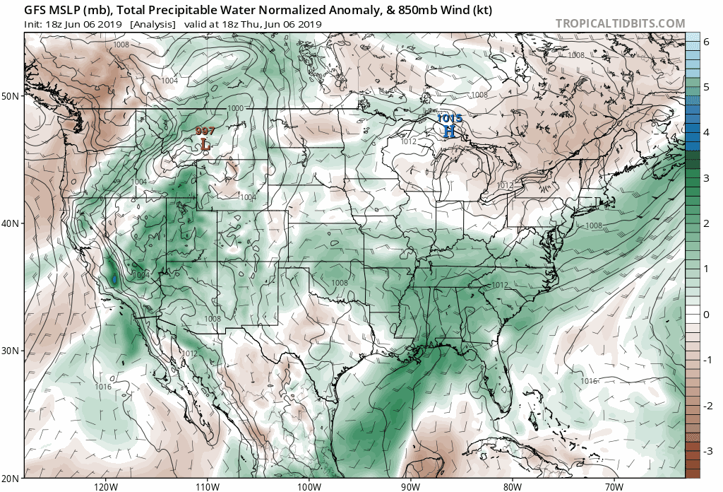
A large, slow moving upper level low is responsible for this abundant moisture that is flowing into the Carolinas. You probably have noticed the increase in moisture over the past 24 hours, and these high dew points will lead to very heavy rain for Friday and this weekend. In matter of fact, models indicate the heavy rain threat may extend into the middle part of next week.
The GFS computer model shows just how much moisture is expected to remain over the Carolinas for the next seven days. Notice the amount of moisture streaming in not only from the Gulf of Mexico but from the Atlantic Ocean.
This constant moisture stream will allow for numerous showers and thunderstorms to develop each day. It will not rain all the time; however, it is difficult to determine when the showers and storms will develop. Any small piece of energy can result in these heavy downpours developing at any time of day, so be prepared for showers from the morning into the overnight hours this weekend.
Heavy Rain Threat on Saturday & Sunday Morning
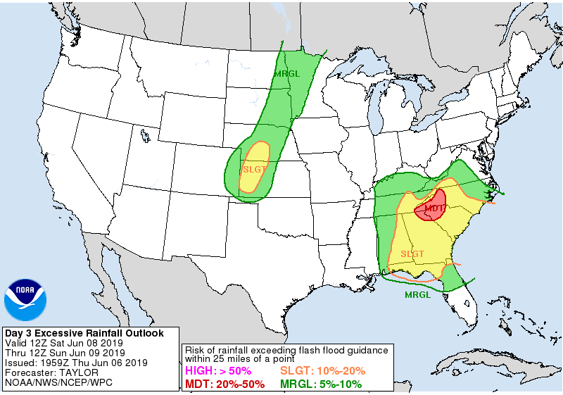
The National Weather Service is especially concerned regarding the amount of rain expected across the Blue Ridge and the foothills Saturday morning through Sunday morning. Winds will be coming from the southeast, which is prime flow to allow numerous heavy showers and storms to develop, especially in the escarpment. Flash flooding is expected to be a problem in this area during the day on Saturday and stretching into Sunday. This elevated flash flooding threat may last into the day on Sunday and Monday as well.
5-10 Inches of Rain Possible Through Sunday Evening in Mountains & Foothills
Over the next three days, 5-10 inches of rain is possible in the Blue Ridge Escarpment. Even though it has been nearly a month since we have seen any major rainfall, this would cause flooding concerns.
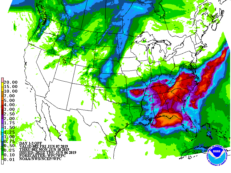
As you move east of the Blue Ridge, lower amounts of rain are expected; however, 2-5 inches of rain is still expected from Charlotte to Raleigh. As you move towards coastal areas, 1-2 inches of rain is expected.
More rain is expected early next week as the system slowly begins to depart, so the storm total will likely be higher than these numbers show.
GFS Precipitation Map Shows Timing of Rain

The GFS computer model shows a broad estimate on when to expect the rain across the Carolinas. It looks like the showers and storms stretch from the morning hours into the evening hours. The takeaway is that it may rain at any time if you are located west of I-95 from the mountains, foothills, and piedmont Friday and this weekend.
Rain Continues Next Week
If you were hoping for a Monday morning drying out, you will be disappointed. It appears this upper level disturbance will be slow to move away, allowing for showers and thunderstorms until the front finally clears near the middle of the week. By the time it is said and done, some areas in the mountains and foothills may see over 2 months worth of rain in just one week.
