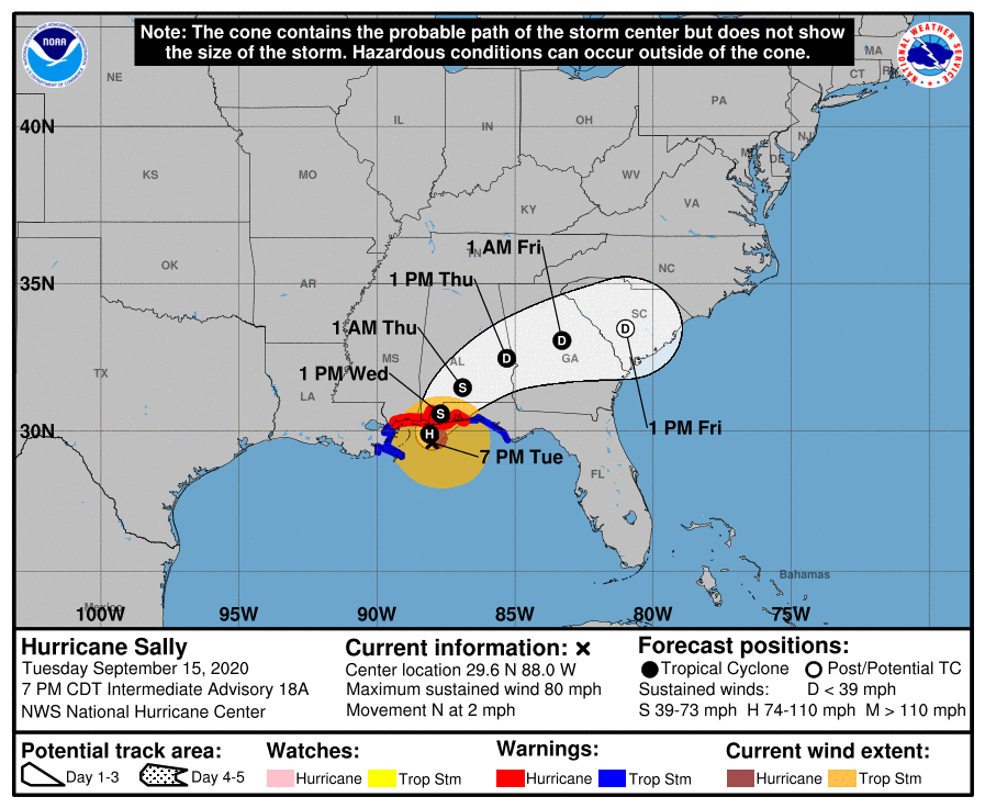
Hurricane Sally is approaching the Gulf Coast this evening and is expected to make landfall Wednesday. After making landfall, Sally will interact with a cold front and is expected to bring very heavy rain to the Carolinas on Thursday and Friday.
Hurricane Sally currently has winds of 80 mph and is slowly drifting north at 2 mph. Sally has been battling dry air, light upper level wind shear, and colder ocean temperatures due to upwelling. Sally remains a strong category 1 hurricane and continues to drop tremendous amounts of rain to on the region.
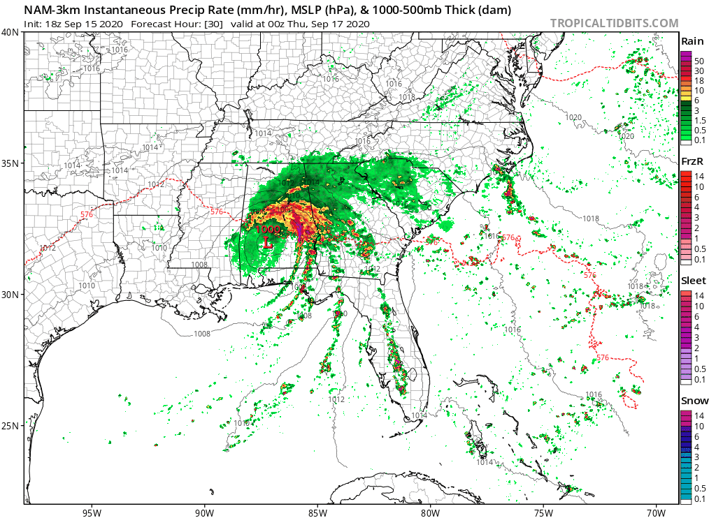
Once making landfall, Sally is expected to interact with a cold front. The tropical moisture coupled with the energy from the cold front is expected to bring very heavy rains to the Carolinas starting early Thursday morning and lasting into the afternoon hours on Friday for parts of the Carolinas. Even though the storm is expected to track to our south, the heaviest rain is expected on the north side of the storm. Below is the NAM Computer Model’s simulated radar.
The rain is expected to start in the western portions during the overnight hours on Wednesday and early Thursday morning. After daybreak, heavy rain is expected from the mountains to the Charlotte metro. This is expected to continue into the afternoon hours on Thursday. By Friday morning, western sections are expected to be clearing out while eastern portions of NC will still be dealing with Sally. By Saturday, most areas are expected to be drying out from Sally.
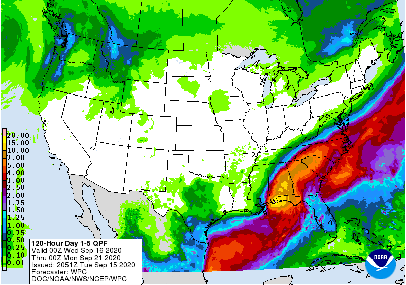
Flooding is possible due to the amount of rain that is expected with Sally. A widespread swath of 3-6 inches of rain is expected from the mountains to the Charlotte metro and along I-85. Locally higher amounts are possible. The Weather Prediction Center has the highest totals right along I-85, but this may change depending on the final track of Sally. The southern facing slopes of the Blue Ridge may also see very high rain totals due to southerly flow against the mountains.
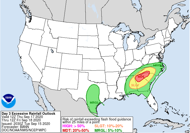
Due to the amount of rain, the Weather Prediction Center has issued a MODERATE risk of flash flooding in the Carolinas Thursday and Friday morning. Be sure to remain weather on Thursday and Friday.
As with any land falling tropical system, please monitor the latest forecasts as minor shifts in the track can change what is expected in your neighborhood.
