The weekend featured mostly cloudy skies and showers for many across the Carolinas, but, March is expected to come in like a lamb with above average temperatures, sunny skies, and tranquil weather.
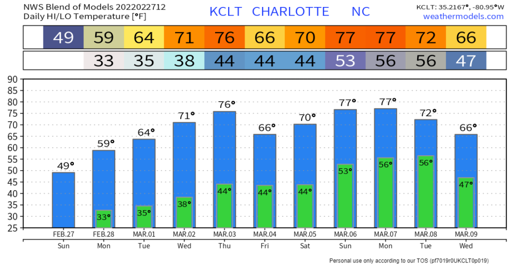
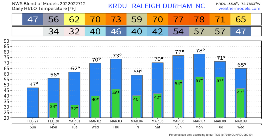
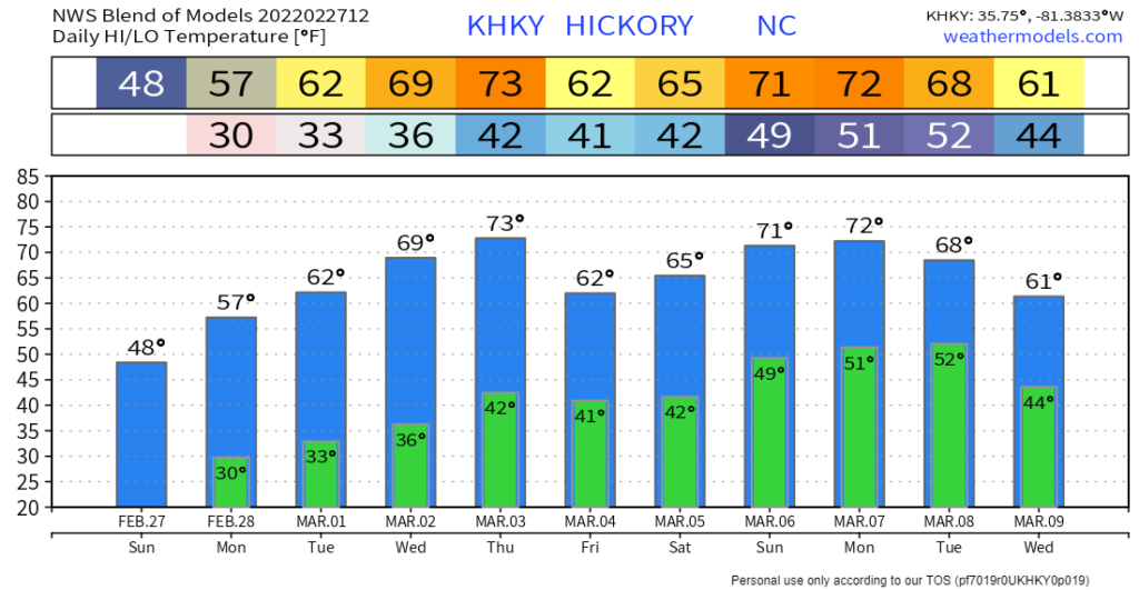
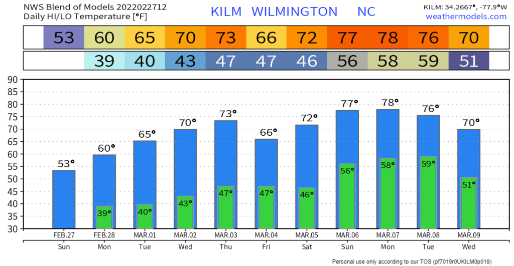
Sunday was a nasty day with cool temperatures and rainfall for many areas in the Carolinas. This front is marching to the east today, and it is expected to bring dry high pressure back into the Carolinas. The change begins Monday with sunny skies returning and seasonal temperatures. But then the warm up starts with temperatures steadily climbing into the 60s on Tuesday, 70s on Wednesday and Thursday, and possibly falling slightly with a weak front on Friday into the 60s. A few scattered showers are possible with the front Friday and Saturday in western NC, but widespread rain is not expected at this time.
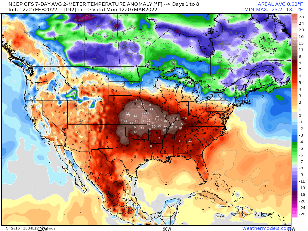
Notice the warm weather stretching across most of the southern United States this week. Over the next seven days, temperatures are expected to remain above average. The average high temperature in Charlotte is 60° on March 1st, so we are expected to be above average much of this week.
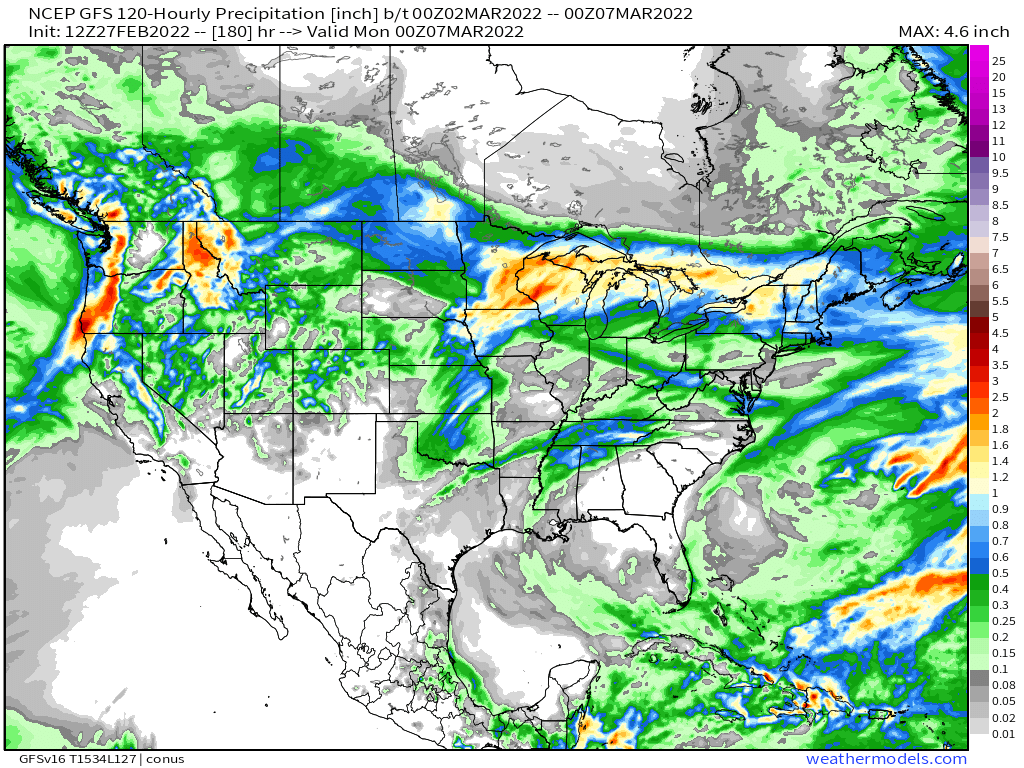
And, with high pressure remaining in control, the rain chances are expected to remain low. The image to your left shows the amount of rain expected from Monday through Saturday. Notice only a small amount of rain is possible late in the week, but there is a considerable amount of uncertainty with the amount of moisture with the front. Overall, dry conditions are expected next week.
Here is the computer model’s high and low temperature forecast for the next ten days. Overall, the temperature forecast is looking pretty good for the start of the month! Be sure to get outside and enjoy the taste of spring!