A mid-November arctic blast is moving through the center of the country and is expected to bring the first accumulating snows to the mountains. Outside the mountains, a few flurries are possible but the big story will be the January like temperatures for Wednesday.
The cold front is expected to enter the mountains around midnight Tuesday and will quickly march from west to east across the Carolinas. By Tuesday night, the front will be exiting the coastal areas and taking the rain with it.
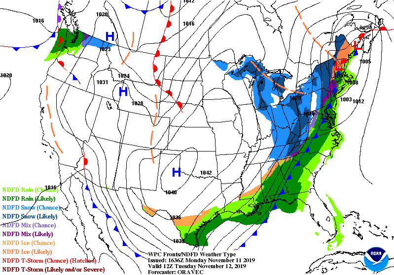
In the mountains, the cold air moving in aloft is expected to change the rain to snow. Boone and Blowing Rock are expected to receive an inch or so of snow, with 3-6 inches possible on the highest peaks of the Blue Ridge and Smoky Mountains.
Outside the mountains, flurries are possible in the foothills with a quick burst of snow possible in the piedmont. Accumulations are not expected as the cold air will be pushing the moisture eastward quickly.
The HRRR short range simulated radar shows the front bringing rain changing to snow to the mountains with rain and a possible snow flurry outside the mountains.

The front is expected to bring between a quarter to a half of an inch of rain for many in the Carolinas. A few areas near Charlotte are still in drought conditions, so this would be welcome news to areas who are still dry.
The major story Tuesday night through the end of the week will be the Arctic temperatures that are coming. These are temperatures that you would expect to see in January, not November. Models are indicating temperatures will be 15-25 degrees below average.
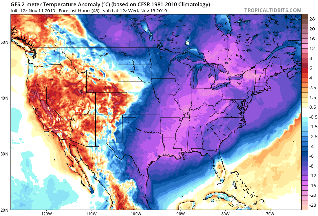
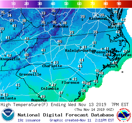
The high temperatures on Wednesday will struggle to reach the mid 40s across much of the Carolinas. Low temperatures will be in the upper teens to low 20s outside the mountains.
A warming trend into the low to mid 50s is expected as we move into the later parts of the week; however, many areas are expected to remain well below average into the weekend.
