More rain is expected this week across the Carolinas, and flooding may become an issue again following the flooding rains from Thursday.
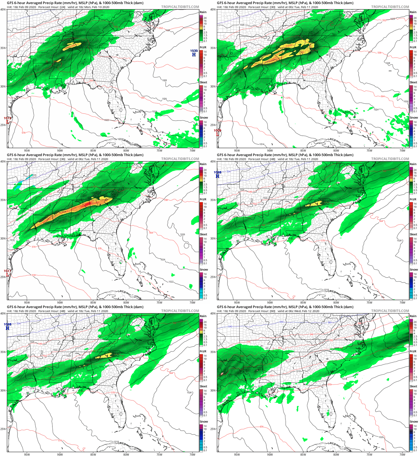
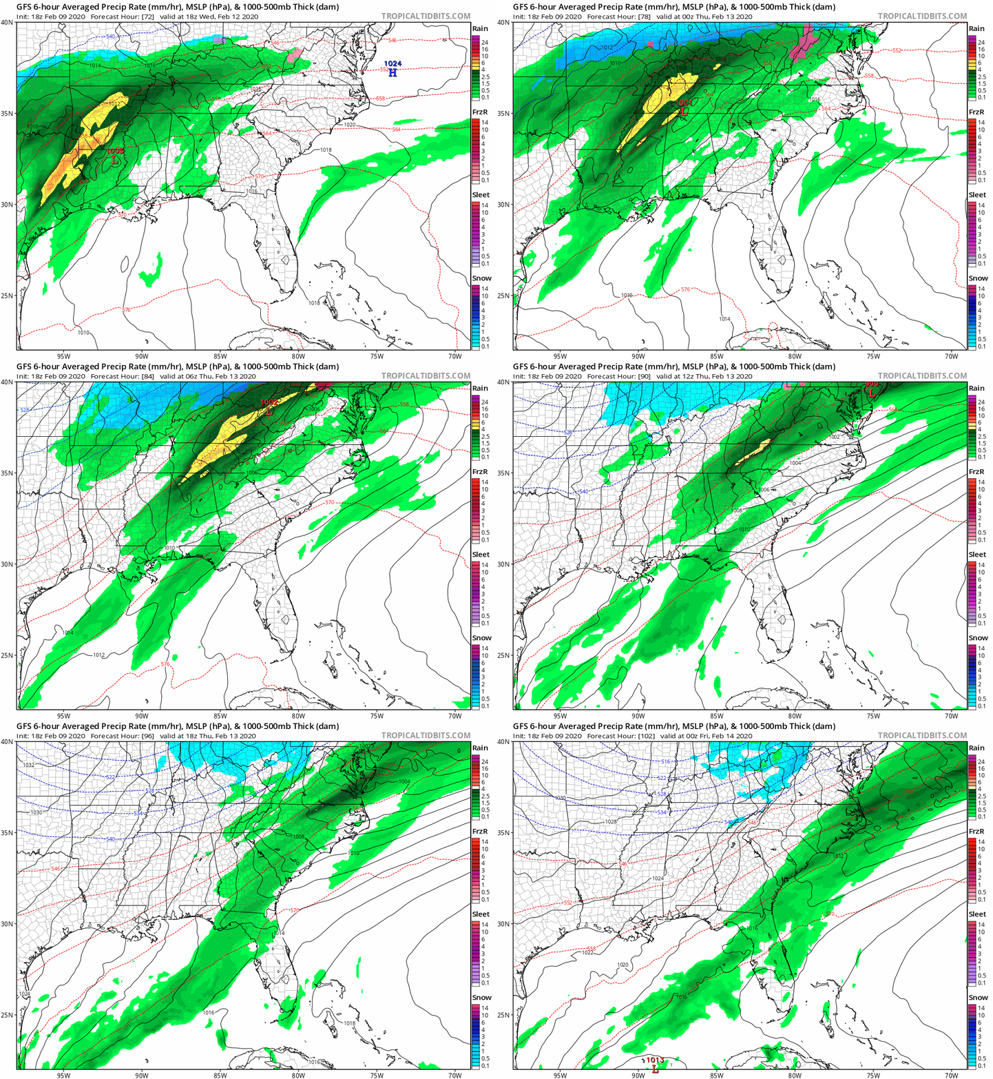
Two rounds of rain is expected this week. The first round is expected to start Monday afternoon and evening, and this round could cause additional flooding in western NC. The front is expected to stall across the Carolinas, allowing a second round of showers to move in later this week. The second round is expected to start Wednesday afternoon and evening before the front finally clears.

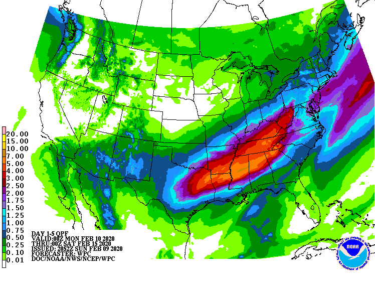
As you can see above, the heaviest rains are expected to remain to our west the next five days; however, far southwestern NC could see an additional 4-8 inches of rain, which may lead to additional flooding concerns. Flood watches have already been issued for portions of the southwest mountains. As you move east of the mountains, 1-3 inches of rain is expected in the foothills and piedmont. Lower amounts are expected in the coastal areas.
MONDAY AND TUESDAY’S SYSTEM
Monday and Tuesday’s system is expected to bring heavy rain to western NC. The rain is expected to begin in western NC Monday afternoon and evening before moving into the piedmont during the overnight hours. These showers are expected to continue through the morning hours on Tuesday.

The first system is expected to drop 2-4 inches across the southwestern NC mountains. Outside the mountains, foothills and piedmont locations may see up to an inch or so of rain from this first system.
WEDNESDAY AND THURSDAY’S SYSTEM
The second system moves in Wednesday afternoon and evening and is expected to depart later on Thursday. This second system may bring a few thunderstorms as the cold front pushes through. Once again, another inch or so of rain is expected outside the mountains, with mountain locations possibly receiving 1-2 inches of rain.

After this second system passes, cooler and drier air is expected to move into the Carolinas. Temperatures are expected to be seasonal for this time of year.
