A powerful Easter storm is organizing over the western United States and is expected to bring severe storms, flash flooding, and strong winds to the Carolinas on Sunday and Monday.
STRONG EASTER STORM TO AFFECT THE CAROLINAS
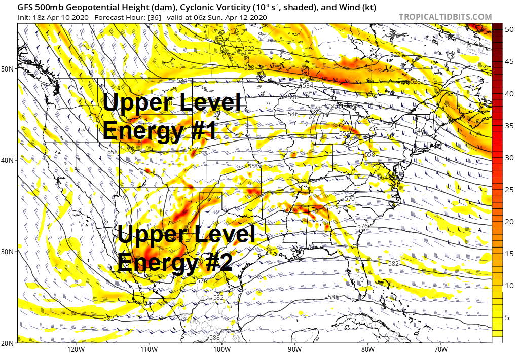
Two separate pieces of upper level energy are expected to combine over the middle of the United States, allowing an area of low pressure to rapidly strengthen and move towards the Great Lakes. With a southerly jet stream gusting over 60 mph bringing warm moist air northward, the Carolinas are expected to be in the warm sector of this storm.
EARLY SUNDAY MORNING 
EARLY MONDAY MORNING
With the strong southerly jet coupled with upper level energy, copious moisture, and warm moist Gulf of Mexico air, the ingredients are there for severe weather across the southeast United States. The Storm Prediction Center has the best chance of severe weather to our south and west, but most of the Carolinas are under a slight risk of severe weather.
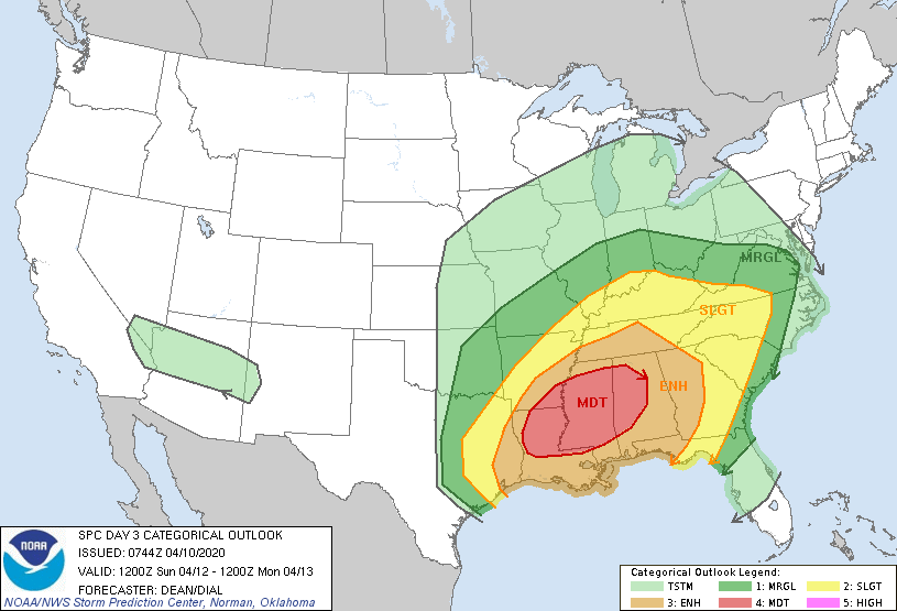
While it is still too early to determine what the greatest threat would be, damaging winds and isolated tornadoes look to be the greatest threats. Of course, many factors will determine what exactly will happen, depending on the timing. Right now, it appears the front will enter the mountains late Sunday night or early Monday morning, which is good and bad. The good news is the front will not be interacting with peak heating, but the bad news is any severe weather that does occur would be at night.
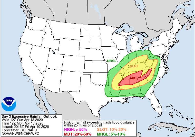
The second threat will be the chance of flash flooding, and this threat is mainly going to be in the mountains and foothills. The strong southerly jet is expected to cause heavy showers and storms to develop most of the day Sunday along the Blue Ridge Mountains. This could lead to flooding concerns, especially during the afternoon hours when a few storms may develop. The Weather Prediction Center has a moderate chance of flash flooding on Sunday.
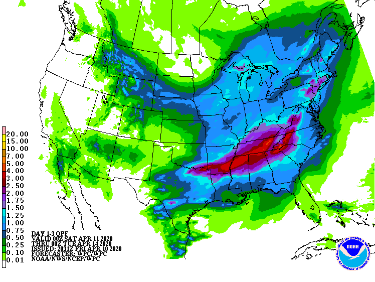
In total, mountain and foothill locations may see 2-4 inches of rain from this system. Most everyone else in the Carolinas are expected to see around an inch of rain, with isolated higher amounts possible.
Before and after the front passes, the winds are expected to pick up as the low pressure strengthens. 30-50 mph wind gusts are possible, with higher gusts across the mountains. Be sure to remain weather aware this weekend and early next week.
