A quick moving system is forecasted to bring a wintry mix of weather from the mountains to parts of the piedmont. While it is not an ideal set-up for snow in the Carolinas, some areas may be able to see the first snow of the winter.
The storm system is expected to track through the center of the country on Wednesday and Thursday before moving across the deep south Thursday Night and Friday Morning. By Friday Afternoon, the low pressure is expected to be off the Carolina coast.
The set up looks good for the mountains to receive snow. Temperatures aloft under the upper level low supports snow for most locations in the mountains. Outside the mountains, the temperatures aloft are cold enough for many; however, ground level temperatures may be too warm to support all snow. Without high pressure helping to bring colder air down from the north, the system has to generate its own cold air through adiabatic cooling. This is the major limiting factor outside the mountains.
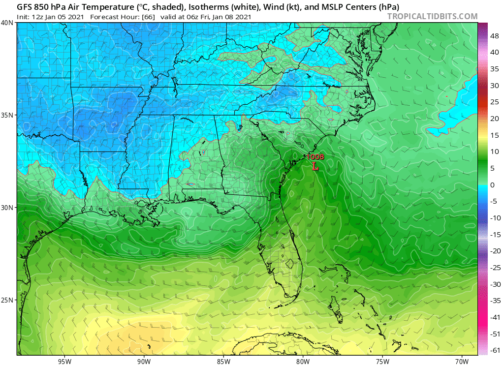
Aloft Temperatures 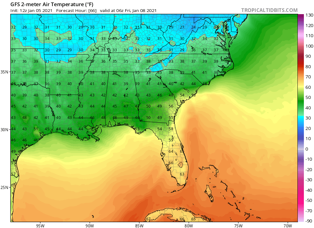
Ground Temperatures
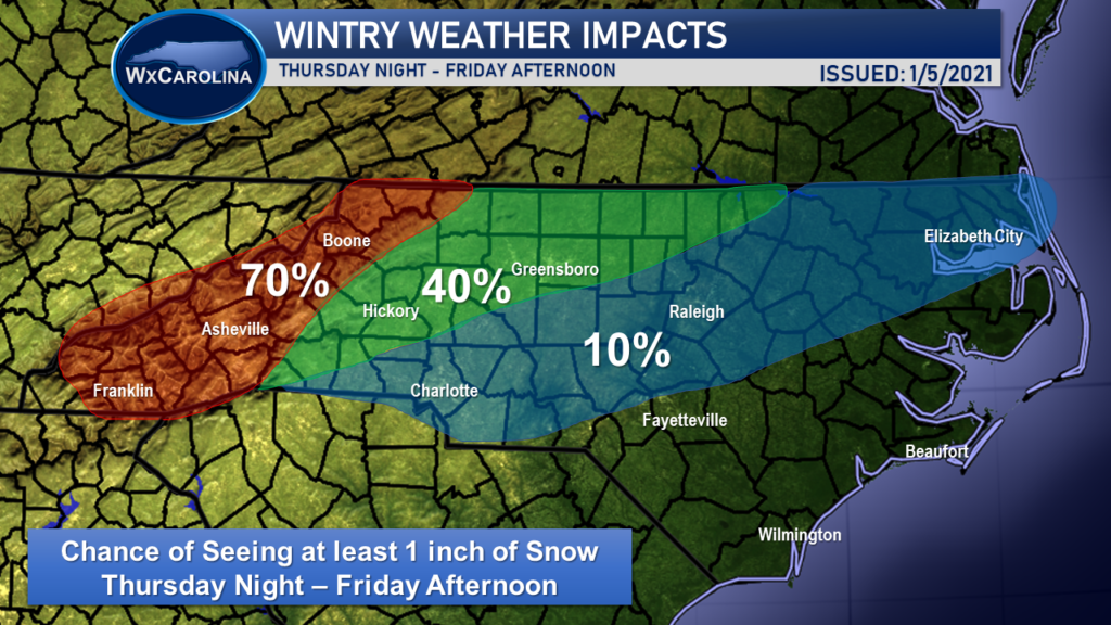
Still yet, I expect some areas, especially along and north of I-40, have the chance to see some accumulating snow on Friday. Below shows my current thinking. The best chance of receiving at least an inch of snow is the mountains, with lower chances along and north of I-40 and the lowest chances near Charlotte and Raleigh.
It remains too early to determine possible accumulations, so be sure to stay tuned for the latest forecast changes. This remains a very complicated forecast, and I will continue to keep you updated with the latest model trends. Be sure to follow me on Facebook for the latest information on this potential winter storm.
