A quick moving system along the Gulf of Mexico is expected to bring the best chance of accumulating snow this winter to the Carolinas.
While there is model uncertainty with this system, the chance of accumulating snow is rising across the Carolinas.

Upper level energy is expected to dive from the midwest and interact with a stalled front along the Gulf Coast and Eastern Seaboard. This upper level energy will help an area of low pressure organize right along the Gulf Coast, tracking across northern Florida into the Atlantic Ocean. The system is not expected to track along the eastern seaboard; however, moisture is expected to move inland as the low pressure organizes.
There are model disagreements with the amount of moisture from the system. The NAM model is the most aggressive and has the most moisture moving into the Carolinas. The EURO model has very little moisture and very little snow/rain moving into the Carolinas. The GFS is the middle of the road and has accumulating snow across parts of the Carolinas.
The image below shows the 18z GFS, and notice the chance of rain/snow mix changing to all snow across much of the Carolinas Thursday evening and Friday morning.
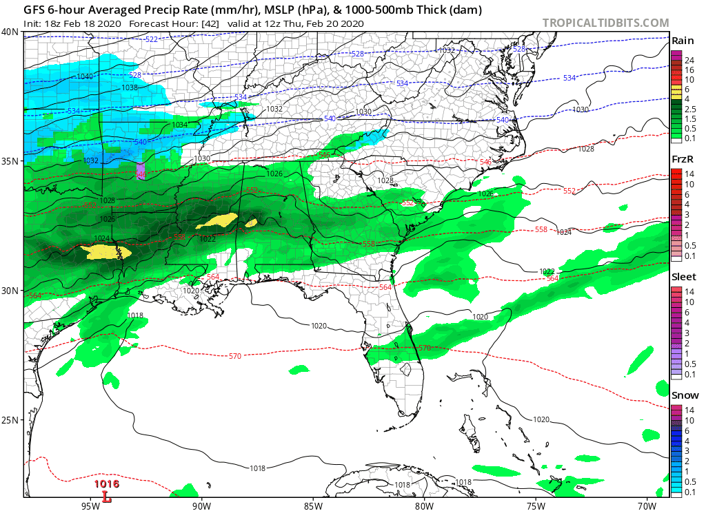
Believe it or not, but it appears there will be enough cold air to support snow for a majority of the Carolinas, with the only exception being southeastern NC.
At the moment, the best chance of accumulating snow is expected in the mountains and along eastern locations. The mountains will be cold enough to where all snow is expected, and eastern locations will be closer to the low pressure and better moisture is expected in eastern NC. The National Weather Service is remaining very conservative with the forecast due to the uncertainty that remains.
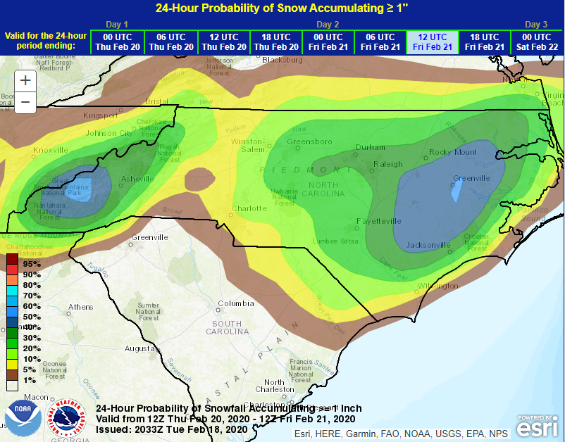
It is still too early to determine an accurate accumulation map, but the best chance of receiving over an inch of snow remains in the mountains and eastern NC. I am planning to issue my first accumulation map on Wednesday when there is more certainty with the track of the system and the amount of moisture.
Continue to make plans across the Carolinas as the snow may impact your Thursday Evening and Friday Morning plans. I will keep you updated on www.wxcarolina.com and on Facebook at WxJordan.
