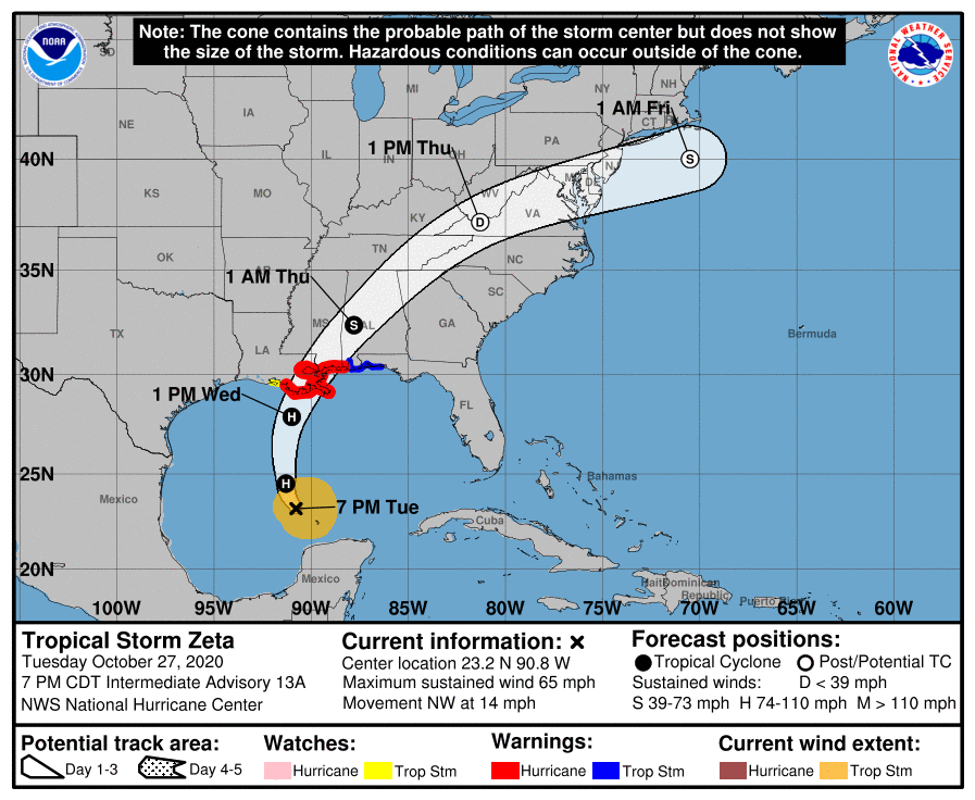
A quick moving Tropical Storm Zeta is expected to interact with a powerful cold front to bring heavy rains and strong winds to portions of the Carolinas on Wednesday and Thursday. The western and central Carolinas are expected to be impacted the greatest.
While Zeta is a tropical storm as of Tuesday evening, it is expected to strengthen into a hurricane Wednesday before landfall. Zeta is a very quick moving system, which means the threat of major flooding will be dramatically lower; however, we will be faced with a greater wind and severe weather threat. The storm is expected to track along the Tennessee / North Carolina border on Thursday, which is when the greatest impacts are expected across western and central NC.
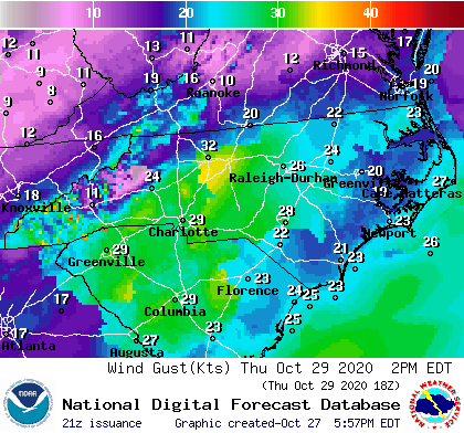
Winds could gust up to 50 mph on Thursday as the system passes by across the mountains, foothills, and western piedmont. These wind gusts coupled with saturated grounds could cause trees to fall and power outages on Thursday.
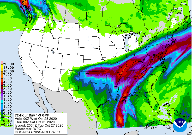
In addition to the wind threat, heavy rain is also expected. The National Weather Service has the heaviest rains located west of I-77 near the track of Zeta. These areas could see 2-4 inches of rain with locally higher amounts possible. Some portions of eastern NC may not even receive rain from Zeta as they are expected to be too far east of the track.
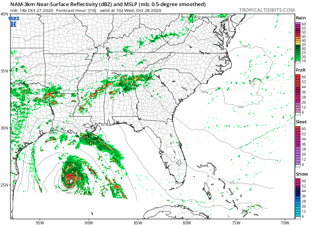
The future NAM radar shows the complex nature of this system. Tomorrow morning, a round of showers is possible before a lull possibly during the evening hours as the warm front moves northward. Then, the second round of showers are storms are expected Thursday morning as the system moves over the mountains. While showers and storms will still be possible during the evening hours, the heaviest rains are expected to be pushing north and east of the Carolinas.
Be sure to remain weather aware Wednesday and Thursday, especially across western and central NC, as we deal with the impacts of Zeta.
