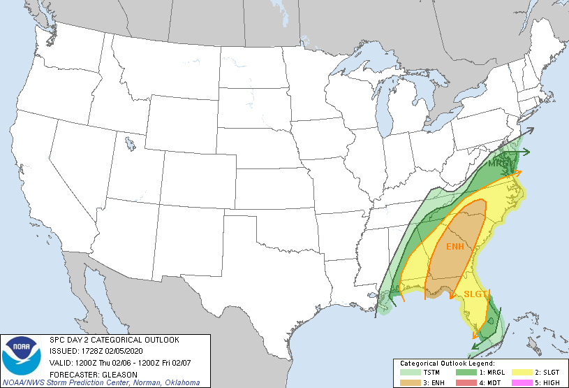
The threat of flash flooding increases Thursday as the rain intensity increases ahead of a slow moving cold front, but there is also a chance of severe weather as the front passes.

The weather map on Thursday shows the potent nature of this front with moisture stretching from Florida to Maine. For us, we are expected rounds of very heavy rain that may lead to flooding and the chance of severe weather.
In the morning hours, showers and storms are expected across the Carolinas. This is expected to increase in intensity during the day and lasting into the overnight hours. The greatest chance of flash flooding will be when the slow moving cold front moves into the mountains, foothills, and western piedmont during the afternoon hours. The High Resolution NAM shows the slow moving nature of the front.

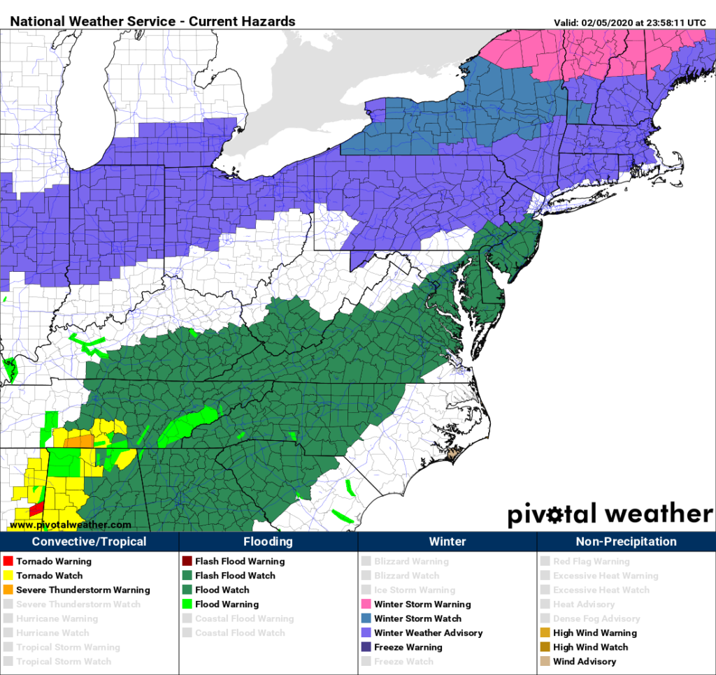
Flash flood watches (dark green) have been issued for tomorrow for the mountains, foothills, and portions of the piedmont of North Carolina. A few flood warnings have already been issued as well in the Carolinas (light green).
By the time the front clears Friday morning, the amount of rain is expected to total nearly one months of rainfall. An additional 3-6 inches of rain is possible in the mountains and foothills of NC from 7:00 p.m. Wednesday. An additional 2-4 inches of rain is possible in the piedmont of NC from 7:00 p.m. Wednesday.

Severe weather will also be a threat due to the amount of wind energy from this system. We will be in a favorable jet streak with winds over 180 mph aloft. Closer to the surface, the low level jet at 5000 feet will be gusting over 75 mph. In some strong storms, these winds can reach the surface. On top of the damaging wind threat, there is also a threat of tornadoes due to the wind energy on Thursday.
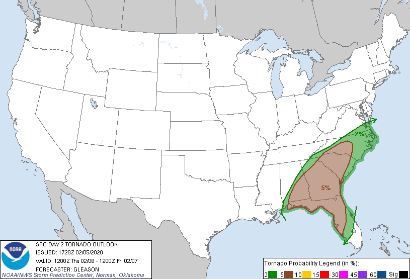
Tornado Threat 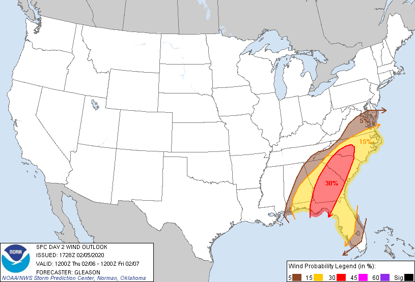
Wind Threat
Be sure to remain weather aware on Thursday as this front passes. Remember to turn around if you approach flooded roadways, do not attempt to cross. In the event severe thunderstorm warnings are issued, be prepared to take necessary precautions, and if tornado warnings are issued, be sure to have your emergency plan ready. Be safe tomorrow!
