After a stretch of weather that featured sunny skies, a change is coming in the form of heavy rain and possible flooding.
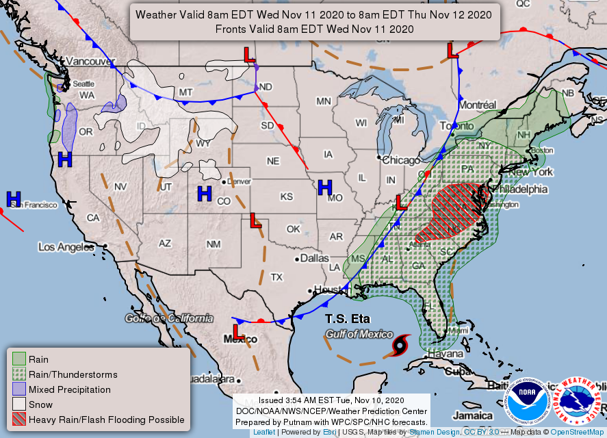
Moisture is increasing across the southeast around an area of high pressure off the Atlantic Ocean and Tropical Storm Eta. This flow is allowing this moisture to bank itself against the mountains, providing some light rain and drizzle on your Tuesday. Eta is actually not causing the heavy rain over the southeast as it is near Cuba, but the overall large scale flow around Eta is help to push Atlantic moisture northward into the southeast. The main driver of this heavy rain will be a cold front.

Overnight, showers are expected to increase from west to east as a cold front approaches. This front is expected to move slowly across the Tar Heel State, so these showers are expected to linger into Thursday as well. Current model guidance pushes the front off the eastern seaboard on Friday, so some areas (especially western areas) may see sunshine by Friday.
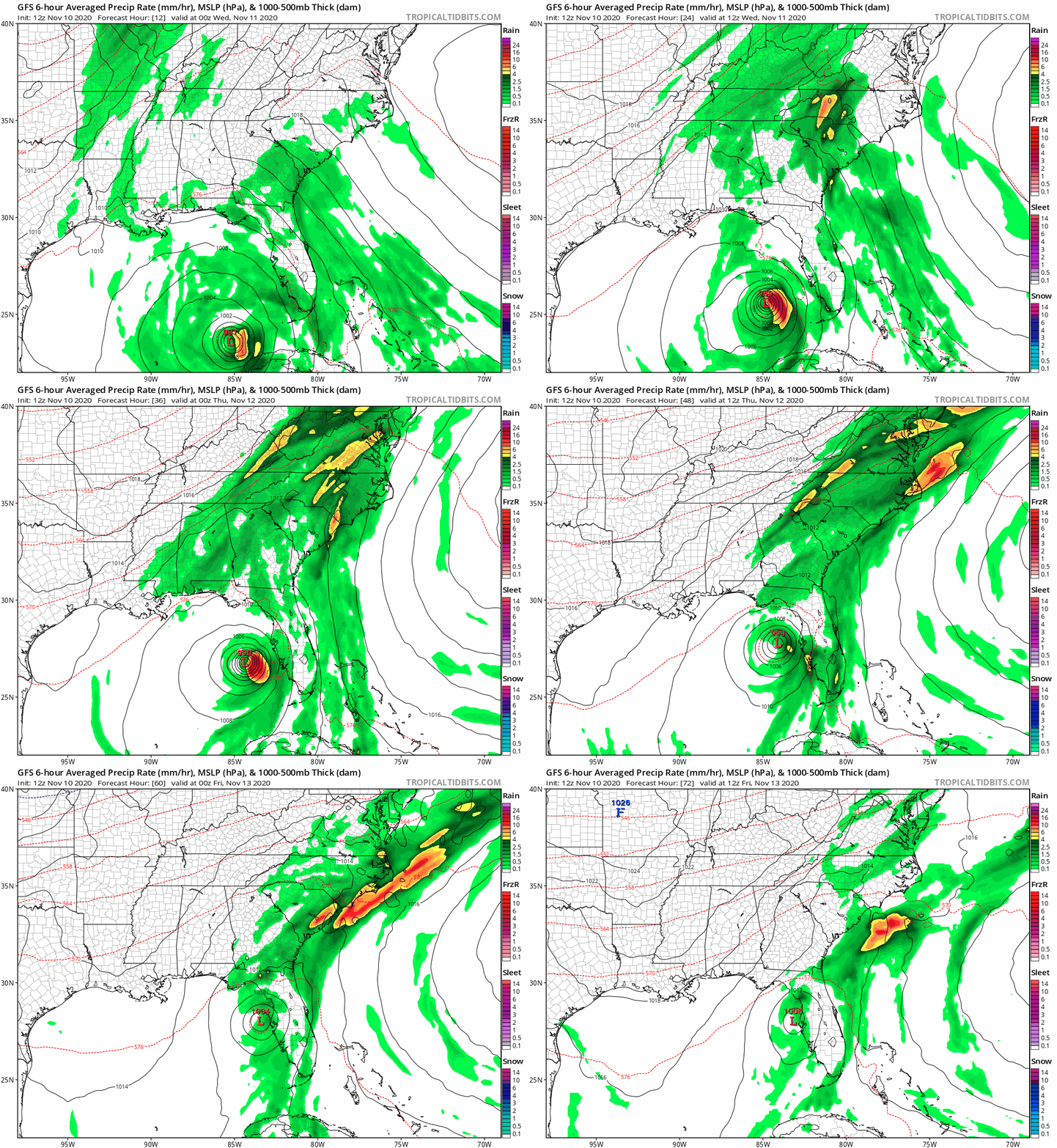
While it will not rain the entire time on Wednesday and Thursday, you can expect the chance of rain at any time given the very moist flow aloft. The GFS computer model below shows the estimated timing of the heaviest rains on Wednesday and Thursday.

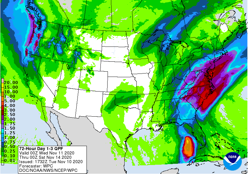
Flash Flooding is a concern with this system. A band of heavy rain is expected tonight and tomorrow morning across western and central NC, so the morning and evening commute on Wednesday is expected to be messy. Be sure to drive carefully and remember, wipers on lights on. The National Weather Service has issued flood watches for parts of the mountains and foothills of western NC. Total rain through Friday morning may be greater than 3 inches in parts of the Carolinas.

As always, please stay tuned to the National Weather Service and local media outlets for the impacts in your hometown.
As for the weekend, another front may impact your plans. While it may not be a washout, there is a chance of showers and storms this weekend. I will have an update later this week on what to expect this weekend.
