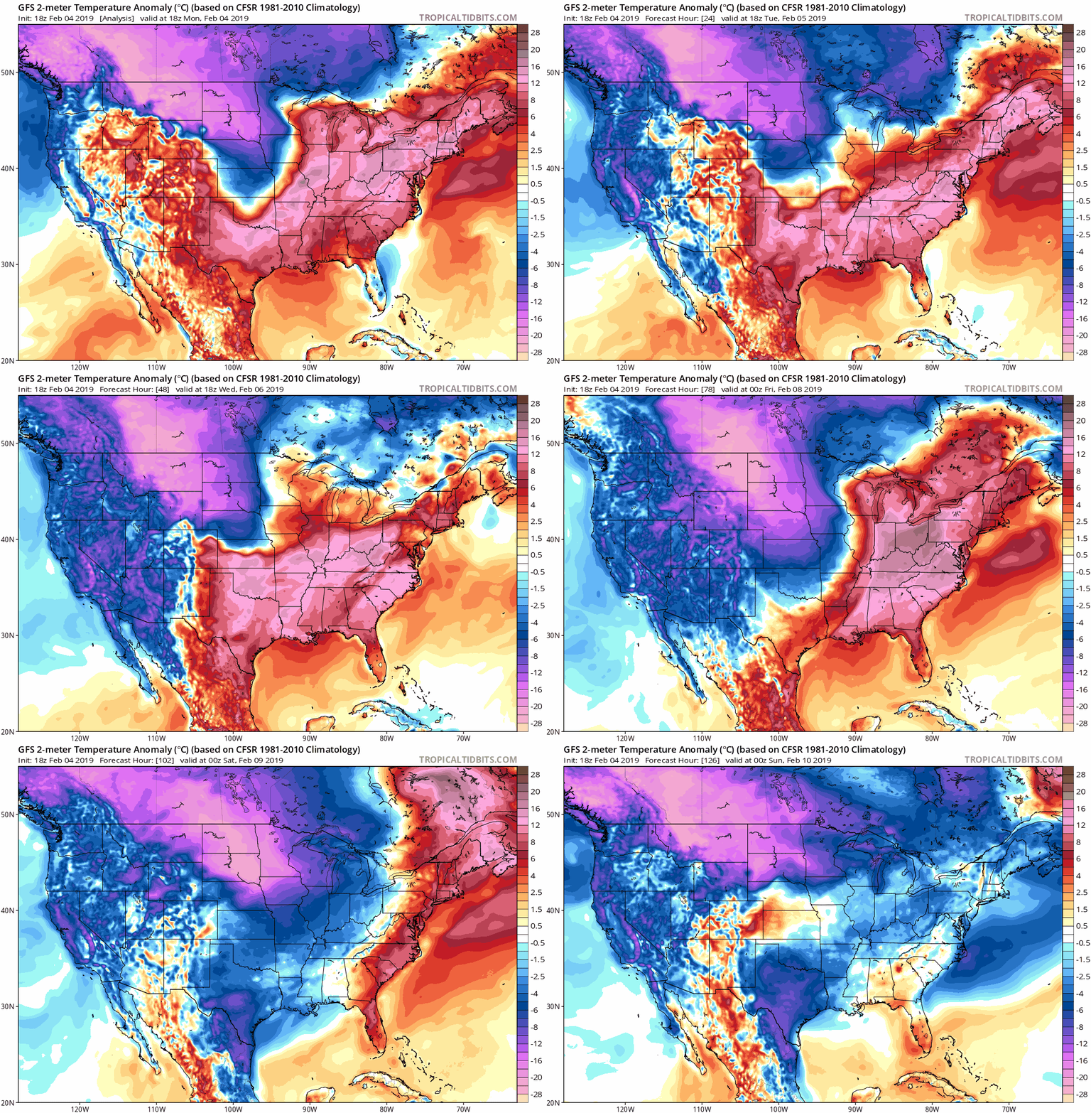
An abnormally strong area of high pressure is leading to temperatures 15-25 degrees above average.
This area of high pressure is expected to remain in control through the end of the work week. This is allowing warmer than average temperatures to move northward into the eastern United States.

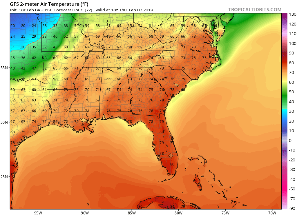
The warmest day of the week is expected to be Thursday; however, record high temperatures are possible on Tuesday, Wednesday, and Thursday.
In Charlotte, the record high temperature is 74 on Thursday and the high temperature is forecasted to be 78. The image below shows the expected high temperatures on Thursday

Temperatures are expected to return to average for February behind a front on Friday. The average high temperature for this time of year is in the mid 50s.
