Tropical Storms Marco and Laura are continuing to move westward towards the Gulf of Mexico, and the current forecast brings two hurricanes towards the Louisiana and Mississippi coastline within 48 hours of each other. Hurricane Watches have already been issued for parts of Louisiana and Mississippi.
Tropical Storm Marco
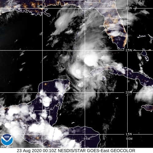
The first storm that is expected to impact the Louisiana and Mississippi coastline is Tropical Storm Marco. Marco, as of 8:00 p.m. Saturday evening, has winds of 65 mph and is moving north northwest at 13 mph. Pressure has been decreasing all day and is currently 994 mb. This is indicative of a strengthening tropical system, and Marco is expected to become a hurricane on Sunday.
Marco is experiencing some upper level wind shear which is helping to keep the storm in check; however, very warm ocean waters are expected to allow Marco to remain a hurricane as it tracks through the Gulf of Mexico. The current track brings Marco northward with landfall along the Louisiana coastline; however, there is uncertainty with the track and it is subject to change.
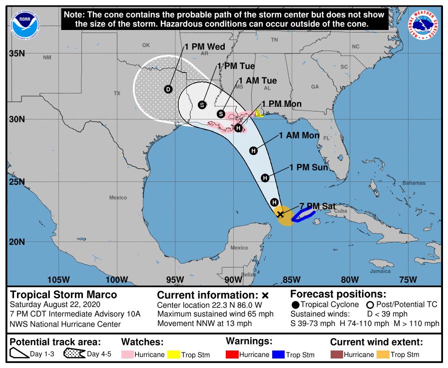
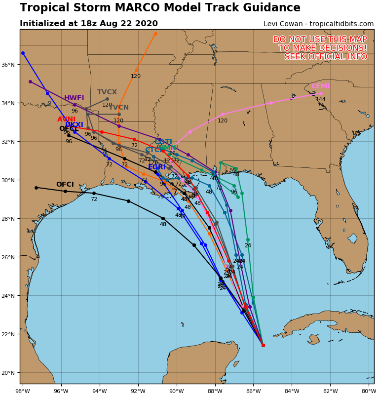
With this uncertainty, please stay tuned to the latest forecasts as there is a chance the forecast track may change again with Marco. If one storm was not bad enough, we have a second storm that has the chance to be a little stronger than Marco.
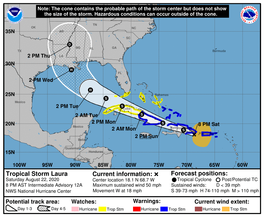
Tropical Storm Laura
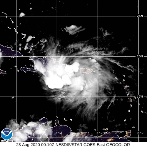
Tropical Storm Laura has spent the day affecting Puerto Rico with winds of 50 mph. It is moving towards Hispaniola and is expected to make landfall on the island Saturday evening. The track with Laura shifted south from yesterday and it is now expected to make landfall in Cuba as well. This will keep Laura weaker as it moves over land. After exiting Cuba, Laura is expected to move into the Gulf of Mexico. Yesterday the forecast brought Laura near Florida, but the track has shifted westward towards Louisiana.
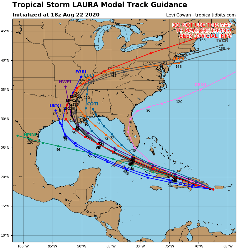
The official National Hurricane Center track brings Laura into the Gulf of Mexico and with the warm waters of the Gulf of Mexico, Laura is expected to strengthen into a hurricane. As it moves northward, it is expected to move over the same waters Marco tracked just a few days earlier. This may keep Laura a little weaker due to cooler ocean waters, but it is still expected to be a hurricane as it moves towards the Louisiana coastline as well on Wednesday. As with Marco, there is still some uncertainty with Laura due to the position of the upper level high pressure and the track of Marco.
Regardless of where you live along the Gulf Coast, from the Panhandle of Florida to the Texas coastline, you need to watch Marco and Laura closely. If you life in Louisiana and Mississippi, now is the time to begin preparing for the possibility of a double hit from hurricanes within 48 hours of each other. I will keep you updated with the latest information and the latest tracks here on www.wxjordan.com and on Facebook at WxJordan.
