Major Hurricane Dorian strengthened Sunday into a category 5 hurricane and made landfall in the Bahamas with winds of 185 mph.
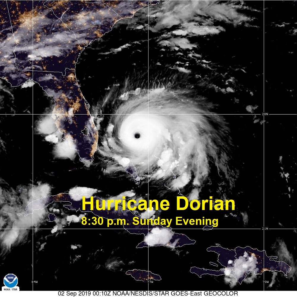
Dorian is continuing to move westward Sunday evening at 8:00 p.m., but during the overnight hours Dorian is expected to slow and begin to move slowly northwestward towards Florida. Overall, Dorian is expected to remain a category 5 hurricane for the next 24-48 hours; however, weakening is expected as the storm moves northward into cooler waters and begins to experience stronger upper level wind shear.
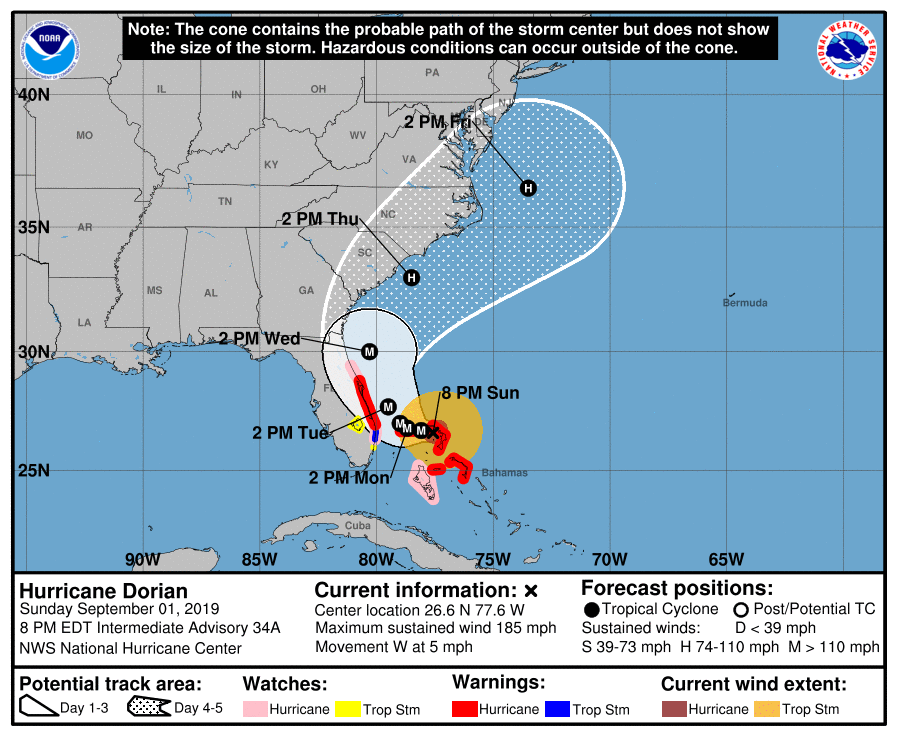
The current National Hurricane Center forecast brings Dorian towards the Florida coastline before moving northward. Right now, much of the Florida coastline remains in the cone of uncertainty. The center of the track keeps Dorian off shore by 20-40 miles, so many Florida communities will definitely feel the impacts of Dorian. Landfall in Florida remains possible at the moment, but regardless of landfall, Dorian will impact Florida before moving northward.
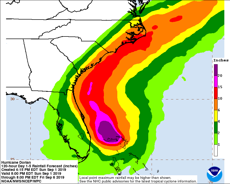
As Dorian moves northward towards the Carolina coast on Wednesday and Thursday, the storm is expected to weaken in terms of wind, but there will still be a very strong storm surge and very heavy rain. The current center of the track brings Dorian into Cape Hatteras, but the cone of uncertainty is very wide at this point. The entire Carolina coastline needs to make preparations now for hurricane force winds, a very strong storm surge, and flooding rains.
Hurricane Warnings have been issued for parts of Florida, and more watches and warnings are expected across the South Carolina and North Carolina coastline later this week.
Please begin making plans now across eastern NC, especially coastal communities for this storm. The Cone of Uncertainty is 100-200 miles wide across the eastern Carolinas, and this storm is expected to be very strong. I will keep you updated with the latest details on www.wxcarolina.com and on Facebook: WxJordan.
