Severe weather is possible on Halloween across the Carolinas, and the Storm Prediction Center has increased the risk to a slight risk for many in the mountains, foothills, and piedmont.

Our short range guidance keeps showers and a few isolated storms in western and central NC through the overnight Wednesday and early morning hours on Thursday. By the late morning hours, a break in the precipitation is expected.
The sun may even come out for some areas, which will allow the atmosphere to become unstable due to strong winds blowing from the south. These southerly winds will help to bring unstable air northward from the Gulf of Mexico. Couple this unstable air with a very potent cold front and very strong wind energy, there is a chance for severe weather during the afternoon hours on Thursday stretching into the morning hours on Friday.
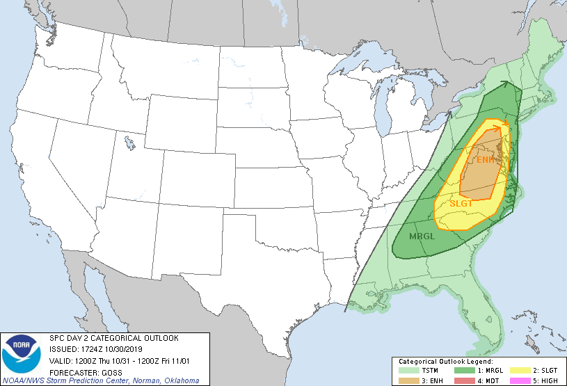
The Storm Prediction Center is taking this risk seriously, placing most of the Carolinas in at least a slight risk of severe weather. A few areas along the Virginia border are in an enhanced risk of severe weather. The greatest threat will be strong damaging winds with the line of storms as it moves eastward; however, there is also a tornado threat. Tornadoes will be possible in storm cells that develop ahead and along the main squall line.
It will be very important to be weather aware tomorrow as this line pushes eastward. Right now, models show the line entering the mountains during the afternoon hours. The photo gallery below is the High Resolution NAM model which shows the progression of the line.

4:00 p.m. Thursday, October 31, 2019 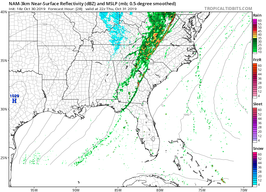
6:00 p.m. Thursday, October 31, 2019 
8:00 p.m. Thursday, October 31, 2019 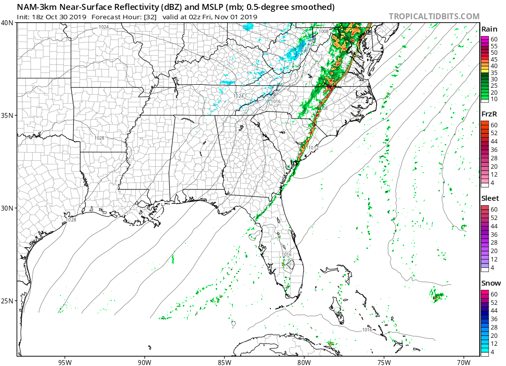
10:00 p.m. Thursday, October 31, 2019
As always, the actual progression of the line may change as we move forward. I will keep you updated on the latest information and any watches that may be posted on my Facebook Page, WxJordan. If you have not liked and followed it, you can click here to view it on Facebook: https://www.facebook.com/wxjordan?fref=ts
