An area of low pressure and cold front will impact the weather in the Carolinas on Thursday.
At the surface, warm moist air from the Gulf of Mexico is expected to move northward. This coupled with strong upper level energy and mid level wind energy will bring the threat for heavy rain and severe storms.
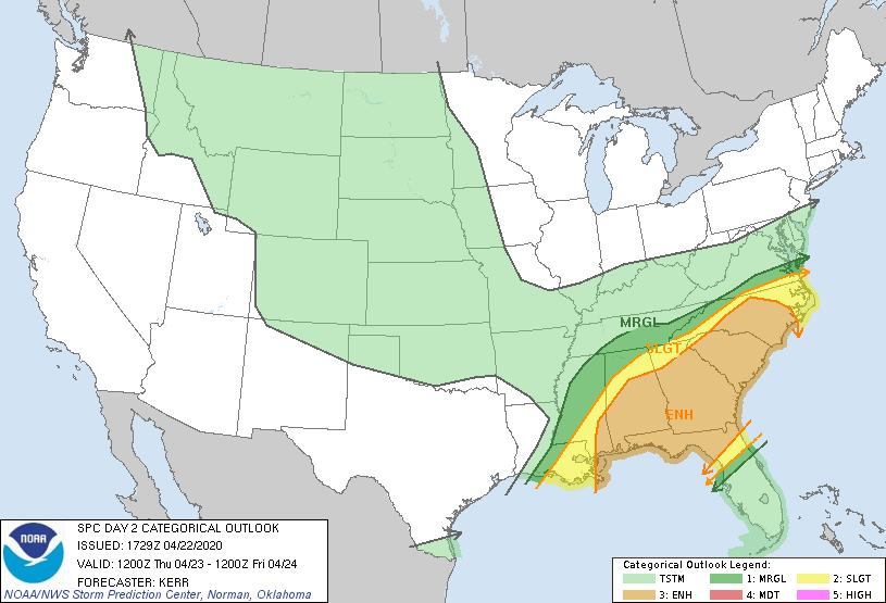
The rain starts in the morning across the Carolinas; however, it is during the afternoon hours that severe storms are possible. The threat continues during the evening and overnight hours in the piedmont. The Storm Prediction Center has placed most areas east of the mountains under an enhanced or slight risk of severe weather Thursday. The greatest threats are isolated tornadoes and damaging straight line winds.

Rain totals are expected to be highest across western NC, with lower amounts as you move east. Flash flooding may be possible in the mountains or foothills, but the greatest threat with this front is expected to be the severe weather.
Be sure to remain weather aware tomorrow.
