A slow moving spring time front is expected to bring a month’s worth of rain in under 24 hours, which is expected to lead to flash flooding in parts of the Carolinas on Thursday.
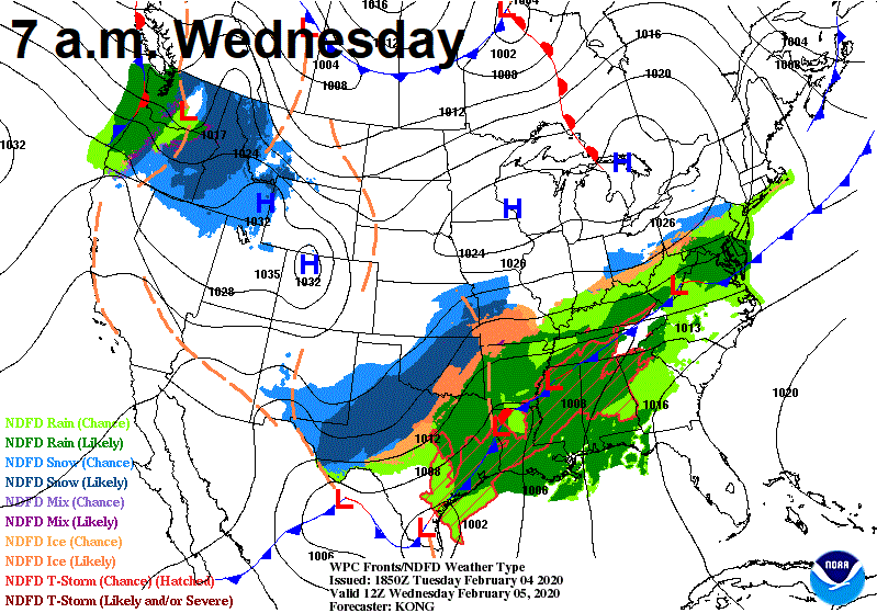
By 7:00 a.m. Wednesday Morning, this front is expected to be organizing across the Mississippi River. High pressure to our east will slow the front’s progression and allow the pace to slow. Aloft, a jet streak at 250 mb of nearly 185 mph will bring moisture and energy northward all the way from the Pacific Ocean.
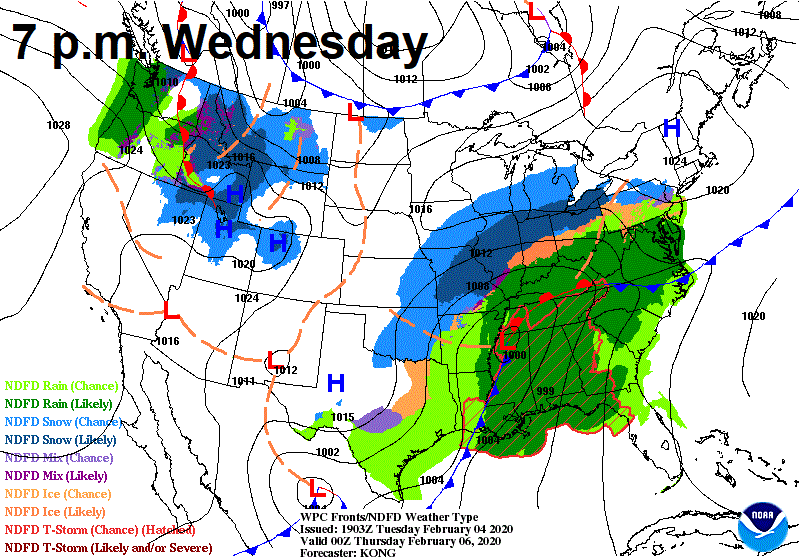
By Wednesday Evening, an area of low pressure will be strengthening along the Mississippi River. Northern locations will see snow, but for us it will be rain. The warm front will lift northward through the day on Wednesday. Wednesday will feature rain, but it will not be as heavy or widespread as on Thursday. The heaviest rains on Wednesday will be confined to the mountains and foothills, but a few heavier showers are possible in the piedmont.
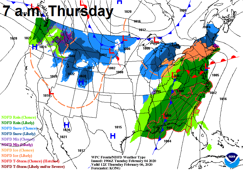
By Thursday morning, heavier showers are expected to develop across western portions of NC, mainly for areas west of I-77. Storms will be possible during the morning hours in the eastern part of the Carolinas, but the main story will be the slow moving squall line that is expected to develop Thursday and slowly move across the Carolinas. During this time, precipitable water values are expected to surge 200% above normal for this time of year.
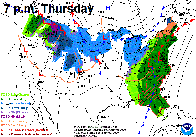
By 7 p.m. Thursday, the slow moving front is expected to be across the I-77 corridor. During this time, very heavy rain is expected with the possibility of severe weather. The greatest flood threat will be during the afternoon and evening hours Thursday for a majority of the Carolinas. Mountain and foothill locations may see isolated flooding during the morning hours Thursday, but the greatest threat even in this area is Thursday afternoon and evening. The flood threat is expected to continue through the overnight hours until the front finally pulls away on Friday morning. As the front pulls away, colder air is expected to arrive, changing the rain to snow.
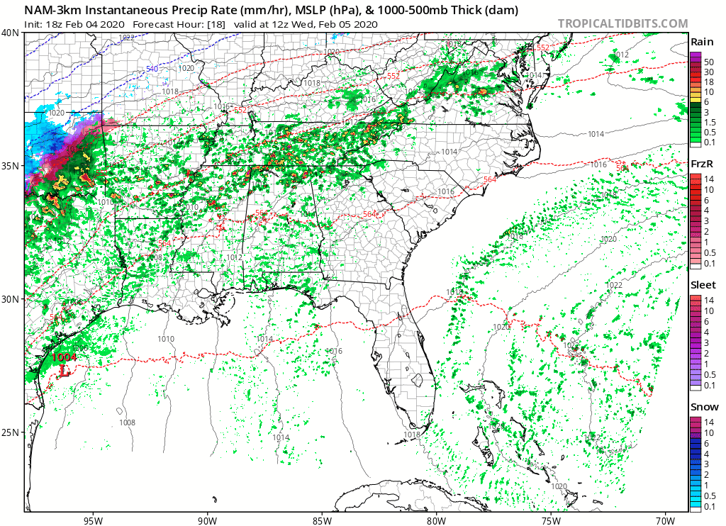
The NAM future radar shows what to expect on Wednesday and Thursday. As you can see, there will be multiple rounds of heavy rain, but the greatest threat remains the slow moving cold front.
Rain totals are expected to be heavy along and north of I-85. The Weather Prediction Center is showing totals of 3-6 inches across many areas in the mountains, foothills, and western piedmont. I would not be shocked if some areas receive over six inches of rain by Friday morning due to the slow moving nature of this front. As you know, six inches of rain in a short time frame can cause major flooding concerns.
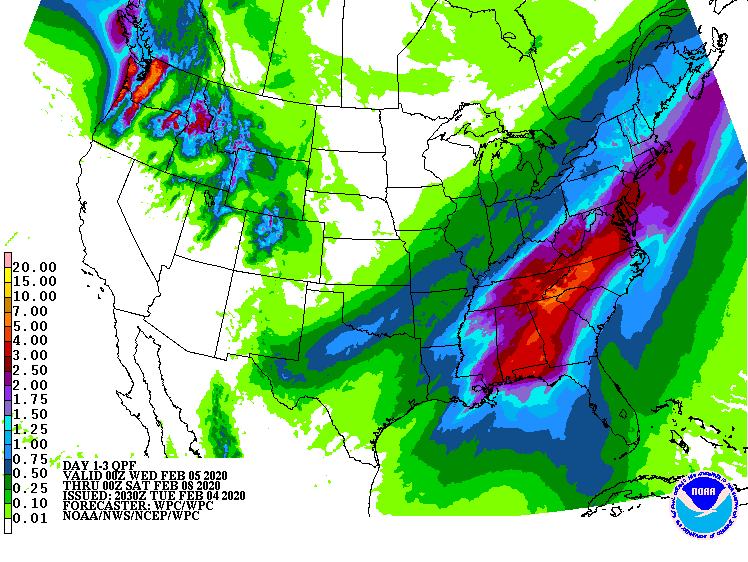
A moderate excessive rain threat has been issued for portions of western and central NC due to this threat. Most flash flood guidance in the Carolinas stands at 2-3 inches of rain in a six hour time frame, and with the slow moving nature of the front and storms, some areas could easily see 2-3 inches of rain, with locally higher amounts. Flash flooding is expected to be a concern.

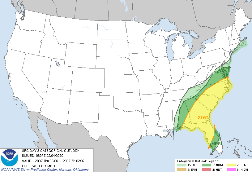
And, if that was not enough for you, there is a severe weather threat with this front. Due to strong upper level dynamics and a very strong jet stream, severe storms are possible. The greatest threat would be damaging winds, but isolated tornadoes are also possible. The SPC has placed much of central and eastern NC under a slight risk of severe weather.
As you can see, this storm system means business. I will continue to keep you updated here on www.wxjordan.com and on Facebook.
