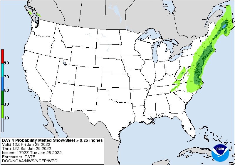
I am still tracking a storm system that could bring some wintry weather to portions of the Carolinas Friday and Saturday.
The NWS shows my current line of thinking very well. It has the best chance of seeing accumulating snow in the eastern portions of NC. This area will be closest to the low pressure as it moves up the coastline.
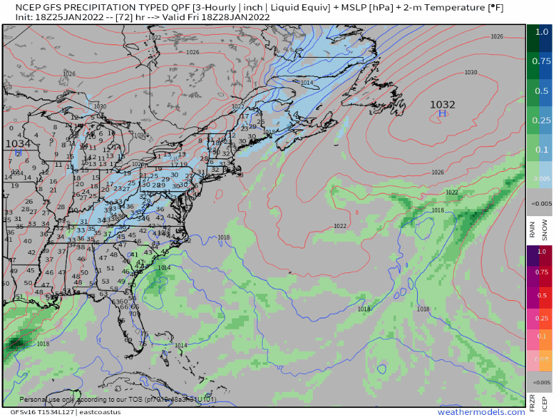
Below is the current animation of the GFS computer model. The current forecast brings an area of energy into the Carolinas on Friday, and an area of low pressure rapidly strengthens over the warm waters of the Atlantic. As it moves up the coastline, current indications are the low would be able to bring some wintry weather into portions of the Carolinas. While we are not talking about a massive winter storm for most, a inch or two is possible for portions of the piedmont and coastal areas. The exception would be northeastern NC once again as you would be closest to the storm track.
The track of the low pressure is key to the overall forecast. If the storm tracks closer to the coast, then it would bring a better chance of wintry weather to western and central portions. But as of right now, the best chance remains in NE NC to see the highest snow accumulations from this system.
I am continuing to monitor the trends and I hope to issue a forecast map tomorrow.
