A strong upper level disturbance is expected to bring a round of severe thunderstorms on Friday from the mountains to the coastal plains. The greatest threat will be damaging winds, but an isolated tornado can not be ruled out.

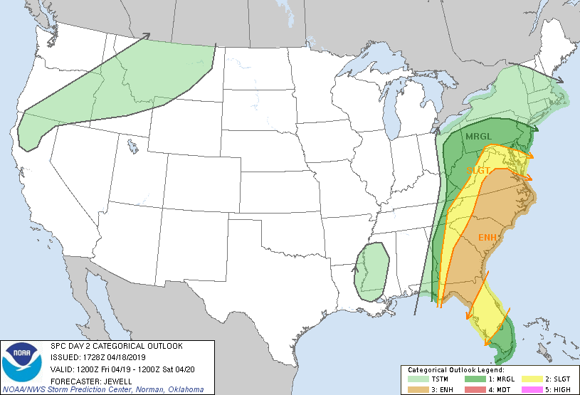
The Storm Prediction Center has placed much of central and eastern NC under an ENHANCED risk of severe weather on Friday due to the amount of CAPE, wind energy, and upper level energy. The greatest threat will be damaging winds as the quasi-linear convective system (squall line) moves eastward. A few isolated tornadoes will be possible as the system pushes through the Carolinas.

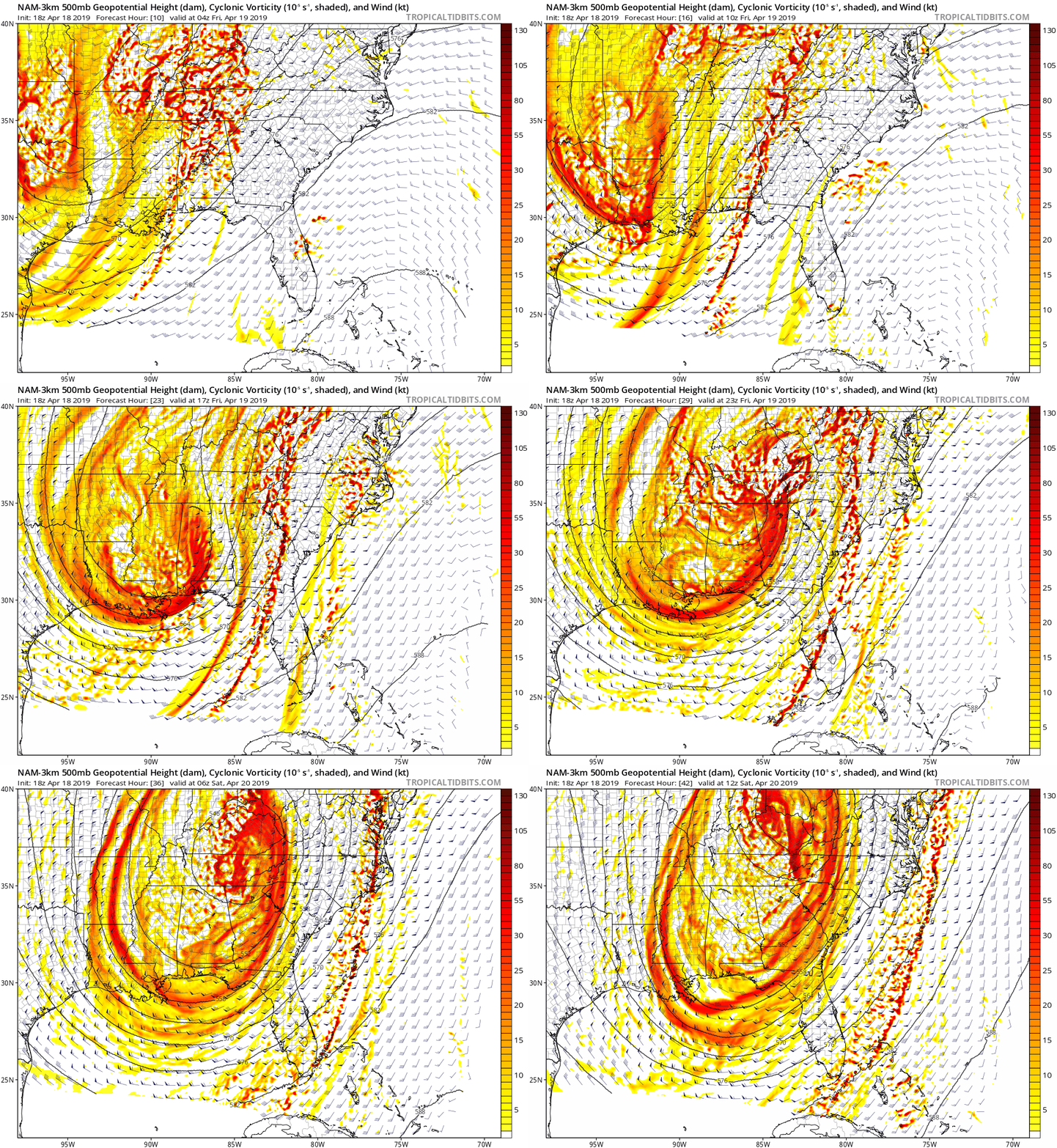
As the upper level disturbance moves towards the Carolinas, notice how the best energy wraps into the southeast during the afternoon hours on Friday. When you couple this amount of energy interacting with max afternoon heating, this will provide the necessary atmospheric condition for severe thunderstorms. You can see the upper level disturbance cut off also Friday afternoon and evening (the isobars become a circle), which indicates a strengthening upper level disturbance.

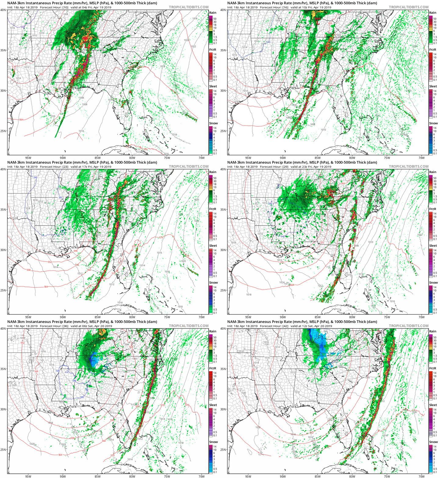
The futurecast radar shows the line of showers and storms entering western NC during the morning hours. The front is expected to slow down while it is in the mountains before moving into the Charlotte metro just after lunch. By the evening hours, the line is expected to push into the eastern piedmont. This is where the strongest storms are expected. The strong storms continue to push eastward into the coastal areas Saturday morning.

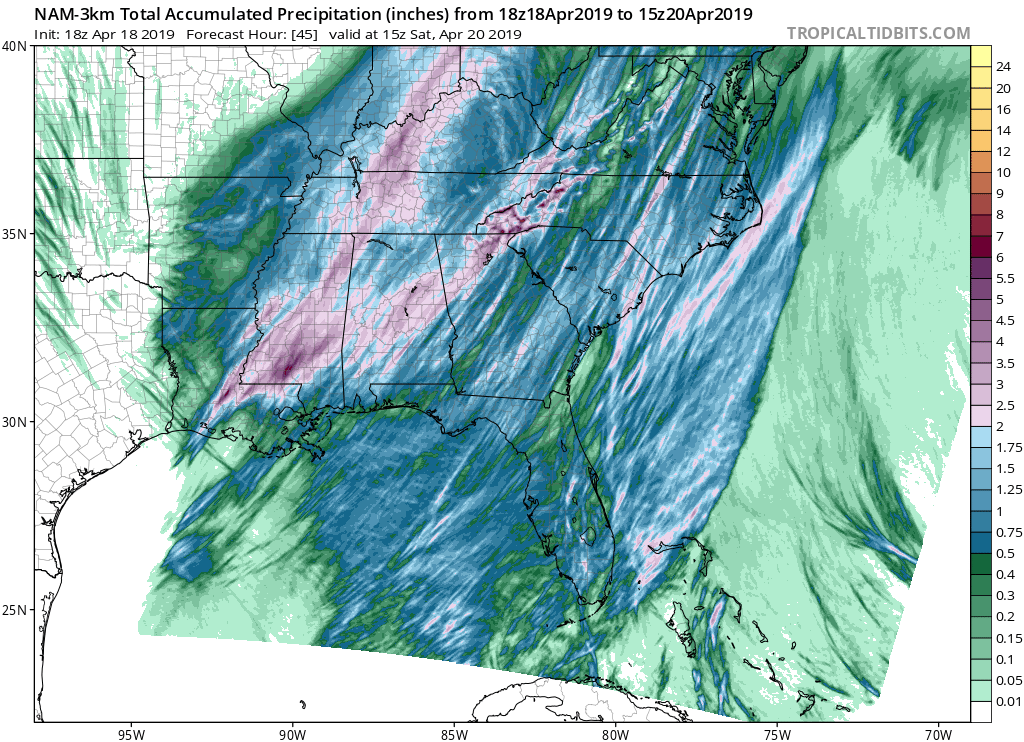
1-2 inches of rain is expected as the front passes through the area. Areas in the mountains may see higher amounts where thunderstorms train over the same areas, but overall, most areas are expected to see a quick 1-2 inches of rain with this front.
Be sure to remain weather aware tomorrow as the system passes. Severe weather is expected, so be sure to make sure you have a plan in the event severe weather impacts your neighborhood.
