A quick moving system this weekend is may bring wintry weather to the Carolinas this weekend. How much wintry weather and the locations receiving wintry weather may still change as new data arrives.
As always, being five days out, I am not going to get into specifics with the system and instead speak broadly about the set up. On Friday morning, a front is expected to pass and bring in cooler air from the north. A few mountain snow showers are possible, but it will mainly be a dry front for most of us.
At the surface, an area of low pressure is expected to be moving southward rapidly out of the Midwest Saturday. Current models are in relatively good agreement this system will dive near the Gulf of Mexico and bring moisture northward Saturday evening and Sunday. The current track brings the system up the coast with wintry precipitation on the west side. How much and what type of precipitation remains in question as we are still 5-6 days out. By Monday, the models pull this system away and sunny skies return.
The final track of the system, as always, will determine the precipitation types and accumulations. While models are in relatively good agreement at the moment, the system’s track may still change which will change the forecast. A more southerly track could mean lower precipitation totals and a more northerly track would be more warm air and less wintry precipitation.

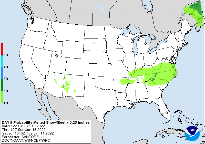
The map above is based on current model data and is subject to change as new data comes in. Right now, the areas in blue shaded have the best chance of receiving wintry weather. If you live in the blue areas, I would begin reviewing winter weather plans. Even outside the blue areas are not out of the danger zone because the track may change, but this is the best track at the moment.
The National Weather Service has most of the Carolinas in at least a 10% chance of receiving a quarter of an inch or more liquid equivalent of snow or sleet, so this system will need to be monitored very closely.
I am continuing to monitor the latest model trends and will keep you updated as we move closer to the event.
