Rain is expected early and late this week; however, temperatures are expected to warm above average for most of the week.
Light icing is possible Sunday evening and early Monday morning across parts of the mountains and foothills with temperatures hovering around 32°. There may be minor traffic issues; however, the icing threat will end quickly as temperatures move above freezing under strong southerly flow.
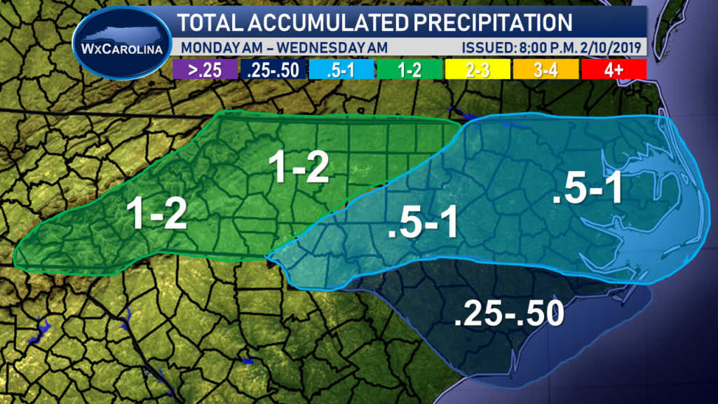
The heaviest rains are expected to arrive on Tuesday as the front approaches from the west. The GFS computer model shows the heaviest rains entering the mountains during the overnight hours and pushing eastward through the day.
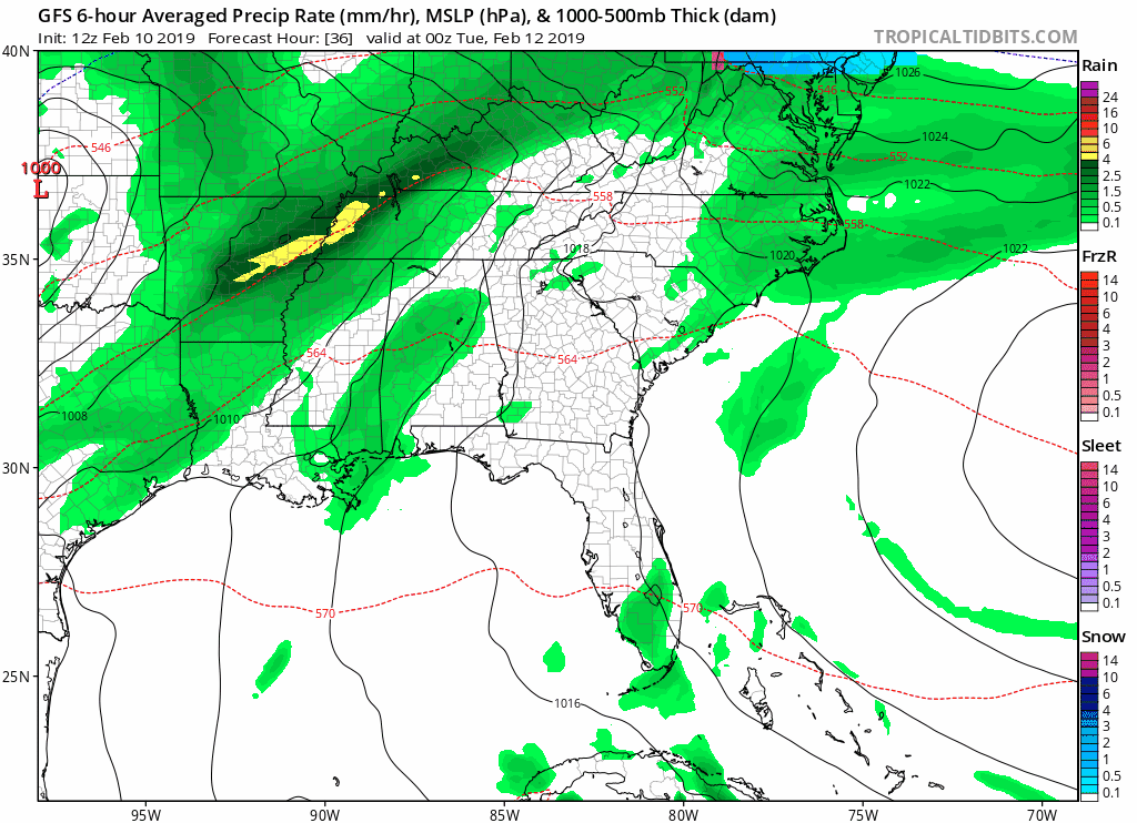
This heaviest rain accumulations are expected to be in the mountains and foothills where 1-2 inches of rain is expected from the system. Lower amounts are expected across the coastal areas.
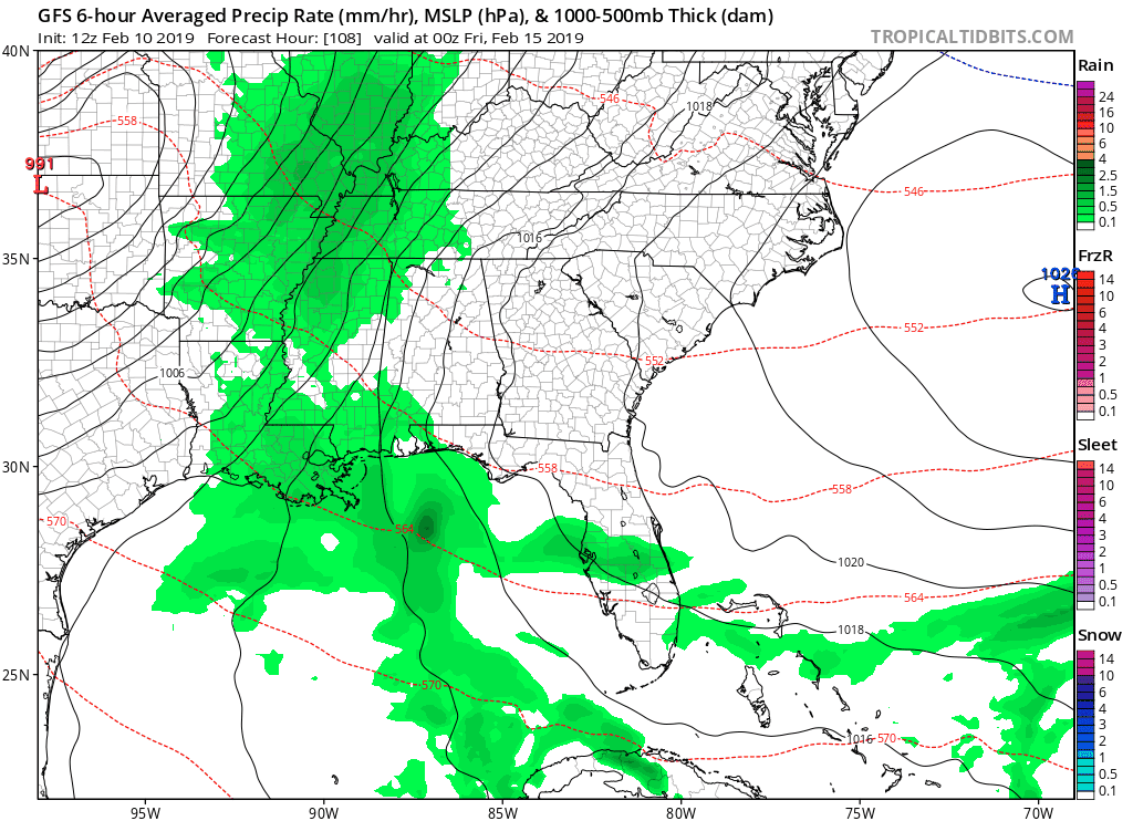
After the front temperatures will remain warm as our second front moves in from the west on Thursday and Friday. This second front may bring more rain than the first system; however, uncertainty remains high because it is so far out.
The GFS computer model shows the system moving in from the west on Friday with showers lasting into Saturday.
The good news is once the front clears, drier conditions are expected to move in for Saturday and Sunday; however, temperatures are expected to be below average for middle February.
