Tropical Storm Barry is continuing to strengthen over the warm water of the Gulf of Mexico and is expected to make landfall in Louisiana this weekend.
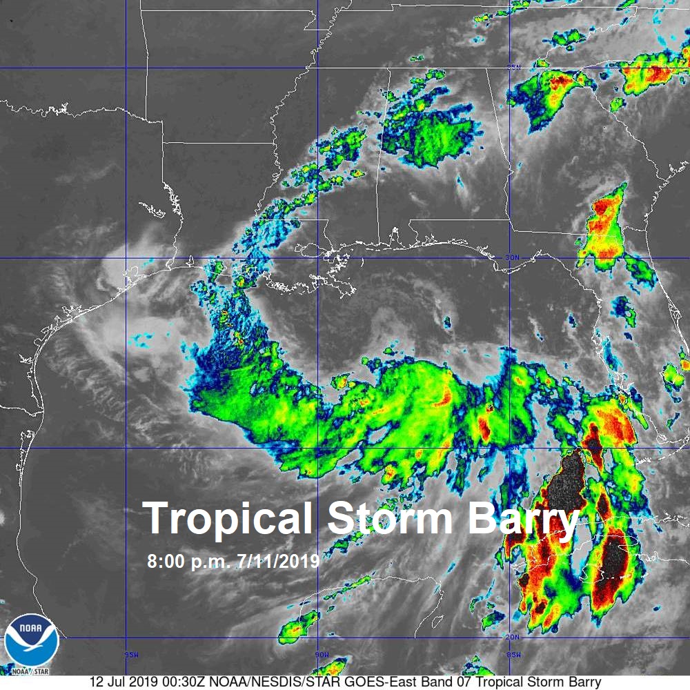
As of 8:00 p.m. Thursday, Barry has sustained winds of 45 mph and is drifting west at 3 mph. The central pressure has dropped to 1003 mb, which indicates Barry is trying to strengthen. Barry is battling upper level wind shear, which is helping to prevent development despite being located under the warm Gulf of Mexico waters.
There is still uncertainty with the track, with the GFS, EURO, and Canadian bringing the system into Louisiana. The cone of uncertainty brings the system onto land between the Texas coastline and the Mississippi coastline.
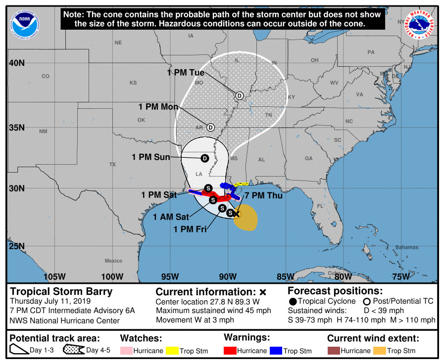
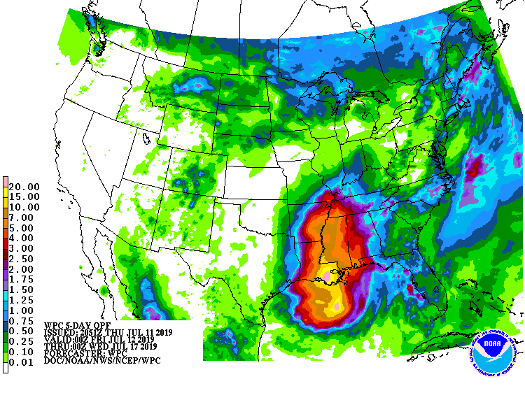
While Barry may strengthen to near hurricane strength in terms of winds, the greatest threat is expected to be the storm surge and flooding due to very heavy rain. Barry is expected to drop up to 20 inches of rain across parts of Louisiana and Mississippi through Sunday. Isolated higher amounts are possible, which will lead to coastal flooding due to storm surge and flooding due to heavy rains.
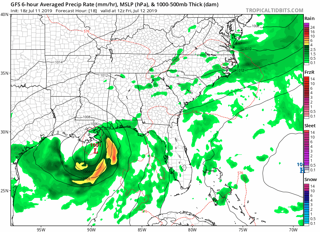
For us in the Carolinas, models keep Barry mainly to our west. A stalled front will continue to allow for showers and thunderstorms this weekend, especially near the NC/SC border. Over the weekend, notice how the GFS keeps most of the shower and thunderstorm activity near I-85.
I will continue to monitor the situation with Barry and will keep you updated with any changes to the forecast on www.wxcarolina.com and on Facebook, WxJordan.
