Tropical Storm Isaias and an upper level trough will work together to bring heavy rain and strong winds to many locations in the Carolinas for the early part of your work week.
There is a lot going on, so we will start with Tropical Storm Isaias and then we will focus on the upper level trough. Isaias has battled upper level wind shear that has really kept the system disorganized. Most of the convection is located east of the center of the storm, and the storm has struggled to strengthen despite warm ocean waters.
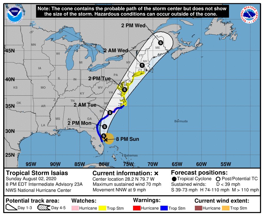
As of 8:00 p.m. on Sunday, Isaias had winds of 70 mph with a minimum pressure of 993 mb. Movement is to the north-northwest at 9 mph. Tropical Storm Warnings and a Hurricane Watch has been issued for eastern portions of North Carolina as Isaias is expected to make landfall late Monday or early Tuesday as a weak hurricane or a strong tropical storm. Greatest threats will be damaging wind gusts, elevated storm surge and rip currents, and isolated flooding.
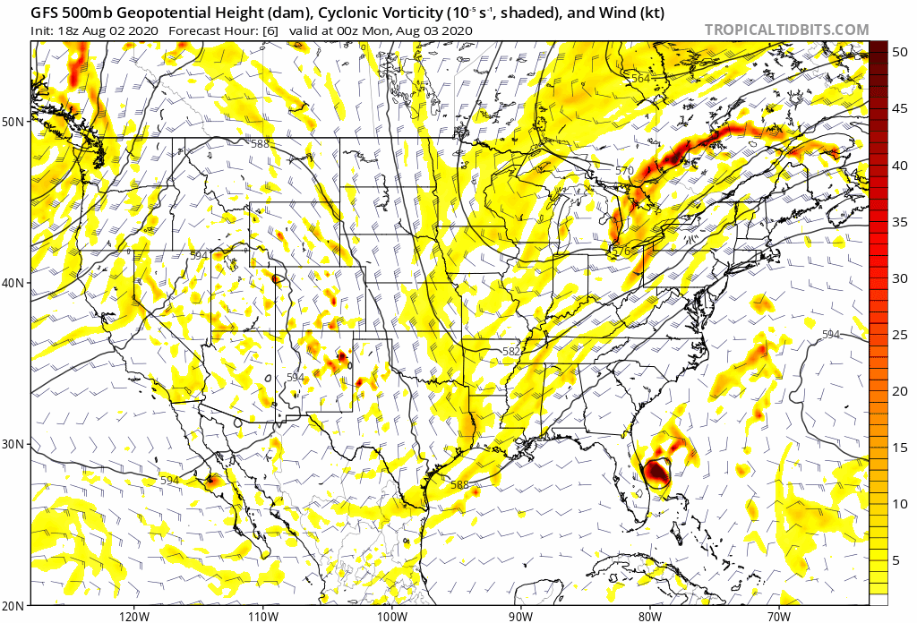
The upper level trough is going to pick up Isaias and send the system out to sea very quickly; however, the trough will interact with moisture coming northward from Isaias and help develop numerous showers and storms far west from the center of the storm across the mountains, foothills and piedmont. You can see how the low Isaias is picked up by the trough and pulled northward quickly on the GFS 500 mb.
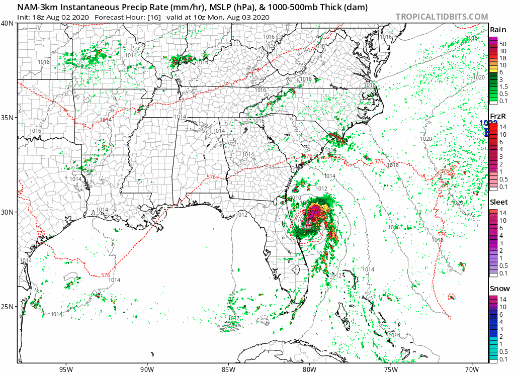
Any of the thunderstorms that develop from Sunday night through Tuesday morning could bring heavy rain. The best chance for heavy rain would be during the afternoon hours on Monday across western and central NC. Coastal areas impacted by Isaias would be affected from Monday afternoon through Tuesday morning. The NAM high resolution radar below shows you what time the rain may start and pull away from the Carolinas.
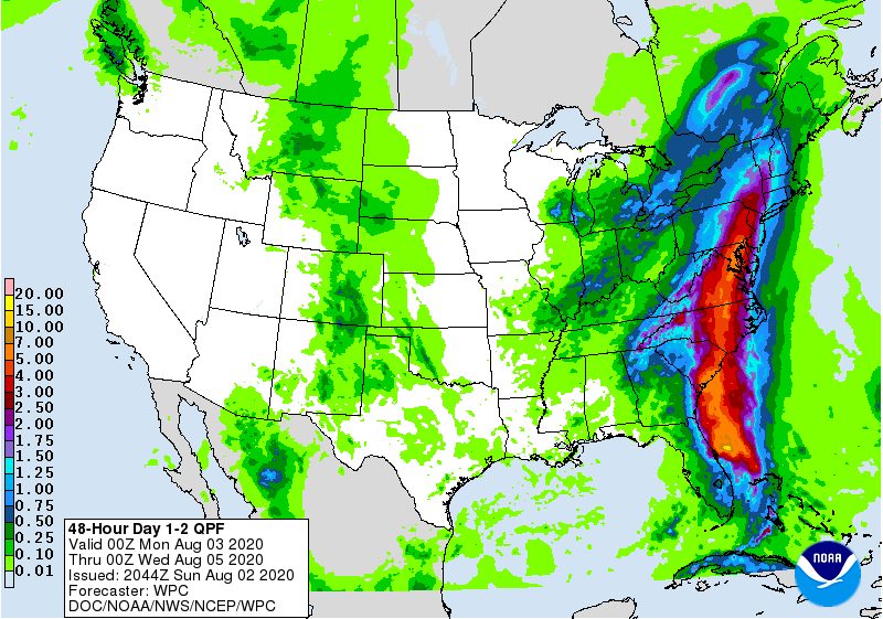
Many areas could see flooding concerns, especially across eastern NC close to where Isaias tracks. 4-8 inches of rain is possible, with isolated higher amounts. Another 1-3 inches is possible across portions of the mountains, foothills, and western piedmont. Be sure to remain weather aware on Monday and early Tuesday morning.
By Tuesday afternoon, we will be returning to a normal August pattern with daily chances of showers and storms with high temperatures in the upper 80s to lower 90s for the rest of the week.
