Tropical Storm Laura is nearing landfall in Cuba before entering the Gulf of Mexico tomorrow. With very warm waters and low wind shear, Laura is expected to develop into a hurricane on Wednesday.
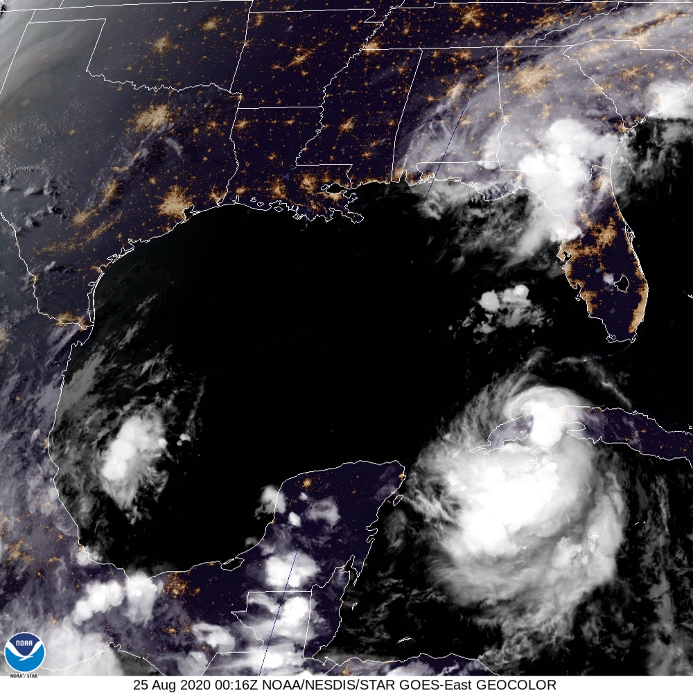
Laura is still trying to organize, but it is dealing with land interaction with Cuba at the moment. Winds are at 65 mph, with the strongest winds east of the center of circulation. Over the past few hours, Laura has tried to organize as it remains over very warm waters. Overnight, Laura is expected to move across Cuba as a tropical storm.
After Laura passes Cuba, the storm is expected to enter a very favorable environment for strengthening. Wind shear is expected to decrease, unlike with Marco, and the warm ocean waters are expected to allow Laura to strengthen into a hurricane. The National Hurricane Center notes a period of rapid intensification is possible with Laura due to the very warm waters.
The official forecast keeps Laura below major hurricane status; however, some computer models strengthen Laura into a major hurricane with winds over 115 mph. We will need to monitor model trends very carefully to see how strong Laura becomes.
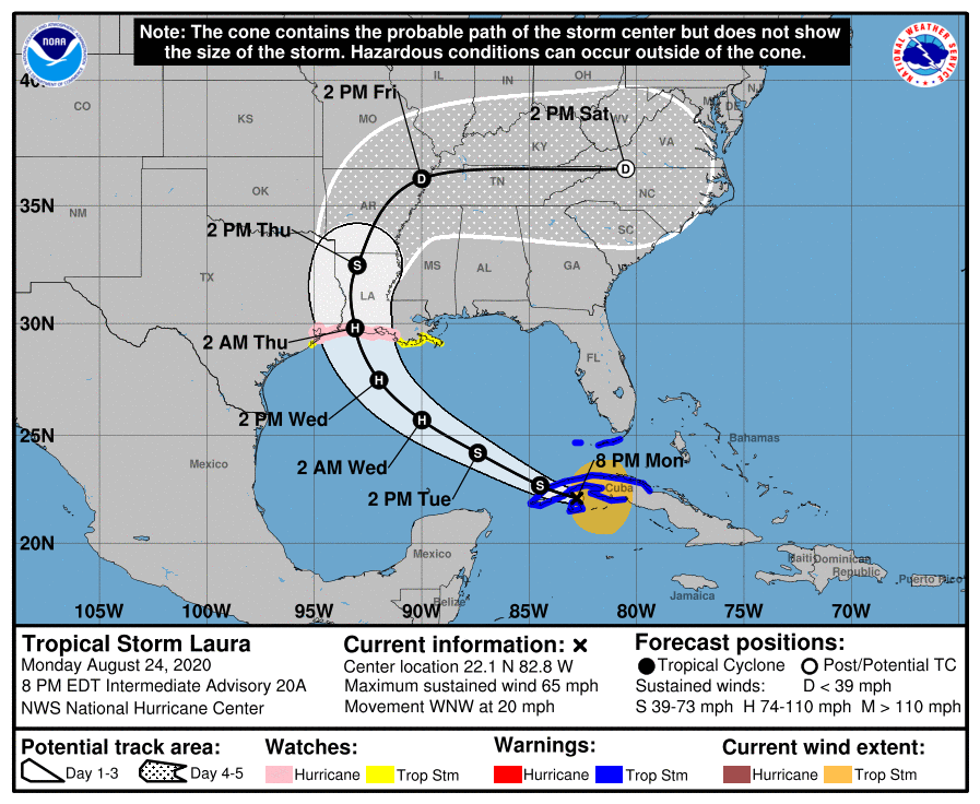
The current track brings Laura northward towards Louisiana with a landfall early Thursday morning. Be making preparations now for the possibility of a major hurricane on the Louisiana coastline Wednesday and Thursday.
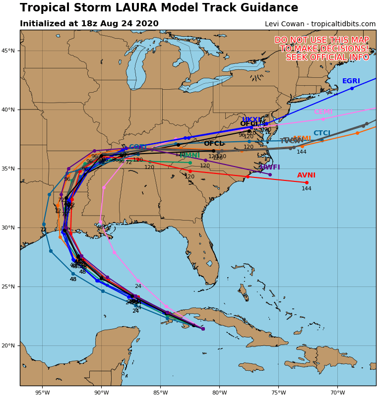
There is very good agreement among the computer models, as seen in the spaghetti plots. Notice the tight cluster just east of the Texas, Louisiana border. While it is possible the track may shift slightly, these areas need to begin preparing for a major hurricane.
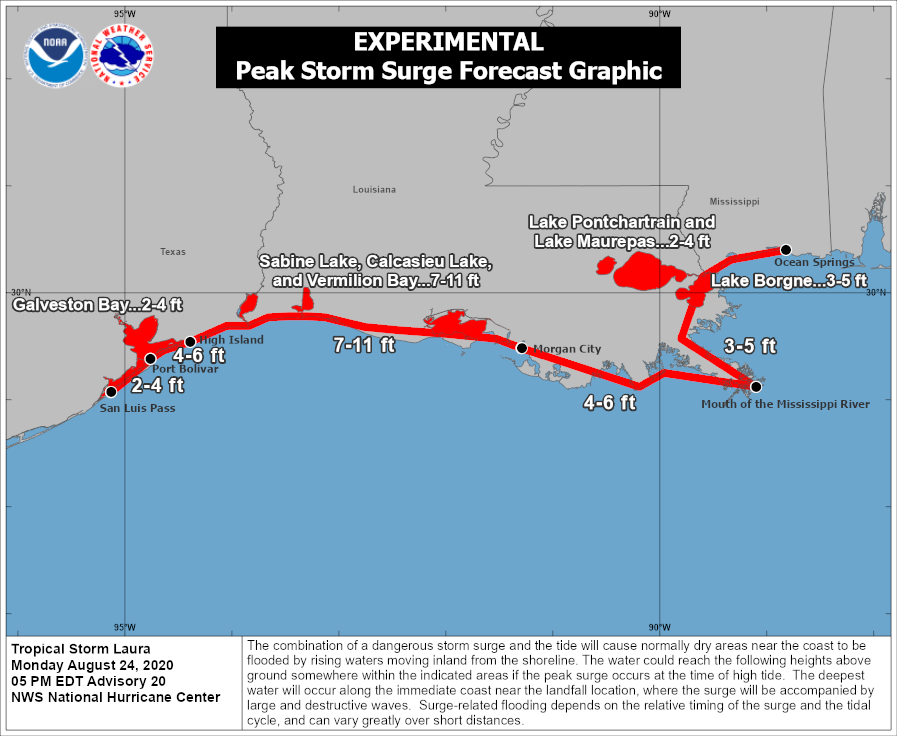
As always with tropical systems, storm surge is expected to be a major issue. Below is the current experimental forecast from the National Hurricane Center. A 7-11 foot storm surge is possible in parts of Louisiana.
For us in the Carolinas, the latest tracks have been bringing the remnant center of Laura over the Carolinas. While flooding rains or very strong winds are not expected at the moment, it will need to be monitored for the possibility of tropical downpours this upcoming weekend.
If you currently live in Mississippi, Louisiana, or eastern Texas, please begin making preparations now for this storm. Have your evacuation plans ready and necessary preparations completed soon.
