Potential Tropical Cyclone #16 has developed in the Gulf of Mexico and is expected to become a tropical storm by Friday morning.
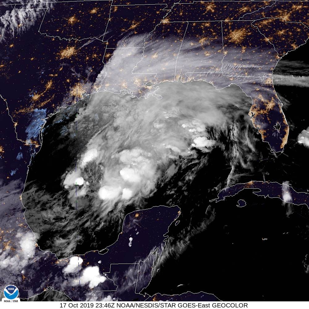
Potential Tropical Cyclone #16 is very disorganized in the Gulf of Mexico. It currently has winds of near 40 mph and is in the process of slowly strengthening. This system is expected to become a tropical or subtropical storm by Friday morning. If it does develop, the system would be named Nestor.
The environment is not conductive for rapid intensification, but the system is expected to make landfall with winds between 50-60 mph along the Gulf of Mexico coast. The current track brings the system into the southeast United States.
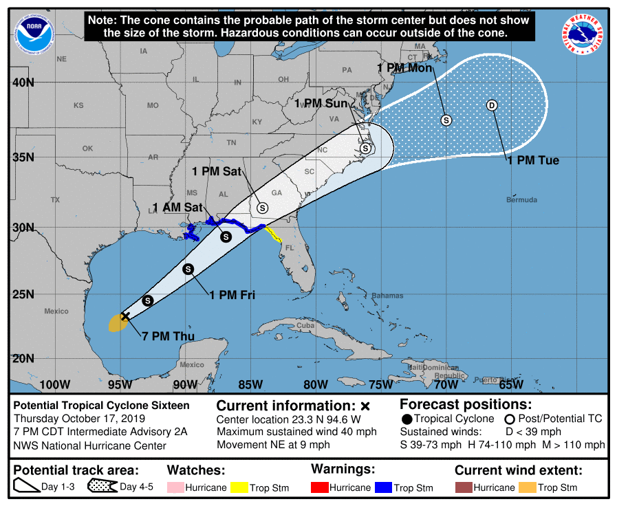
This track will bring the remnants of the system into the Carolinas, bringing periods of very heavy rain and possible tropical storm force winds. The system is expected to interact with an upper level disturbance to the west, allowing for precipitation to develop on the northwest side of the storm.
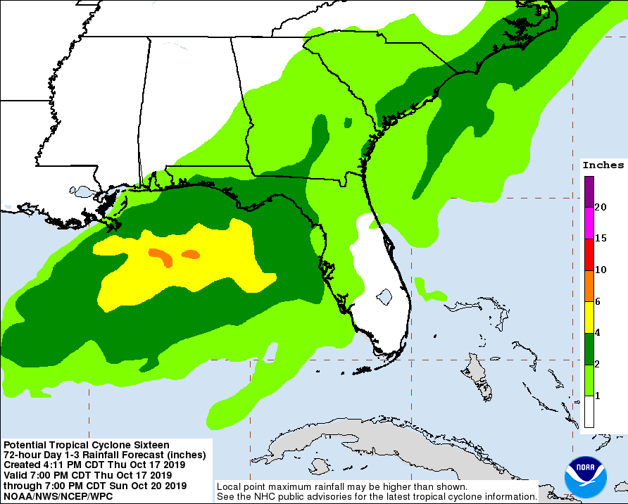
The rain is expected to start during the afternoon and evening hours Saturday, lasting into the morning hours Sunday. The system will quickly pull away Sunday evening from the coastline with rapid clearing behind the system.
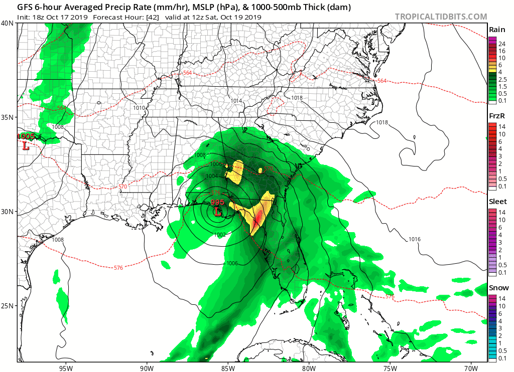
The image above is the GFS computer model, and notice how the system quickly moves northeastward from Saturday morning until early Sunday afternoon.
The heaviest rain is expected to be east of I-77 in the coastal areas, where 2-4 inches of rain is possible. Areas west of I-77 is expected to receive lower amounts of rain, but and inch of rain is still expected in the mountains and foothills. Rain totals may change depending on the final track of the storm.
I am continuing to monitor the situation and will keep you updated on the track of Potential Tropical Cyclone #16.
