Temperatures across the Carolinas are 10-20 degrees below average for this time of year as a cold front brought a major change; however, the tropics are beginning to heat up as a new tropical storm has developed.
Wedge Brings Break From Summer Heat
A cold front pushed to our south Friday evening, allowing high pressure to push cooler air from the Atlantic Ocean into the Mid-Atlantic and Southeast. These cooler temperatures will not be leaving quickly either. On Sunday expect another cool day by late August standards with temperatures 10-15 degrees below average.
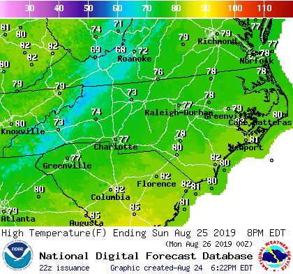
Temperatures will slowly rise through the upcoming week as the wedge erodes by the middle of the week. By Labor Day weekend, temperatures are expected to return to average for late August and early September.
Tropical System Organizing off Carolina Coast

An area of low pressure off the Carolina coast is organizing and trying to develop into a tropical depression. The National Hurricane Center is monitoring this area very closely, especially since it is very close to the Carolina coast. The good news is the system is expected to move along the coast and landfall is not expected at the moment. The bad news is the system is expected to cause increased wave heights and increased risk current risk along the coast.
Tropical Storm Dorian Develops in Central Atlantic
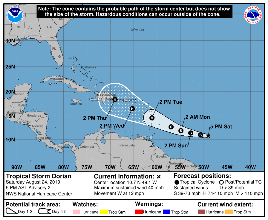
Tropical Storm Dorian has developed into a tropical storm with winds of 40 mph in the central Atlantic. While it is very far away from land, the current track brings the storm towards the Lesser Antilles on Tuesday, potentially as a hurricane. As it enters the Caribbean, it is expected to move northwestward as a hurricane. This system will need to be monitored very closely as the environment is favorable for development.
