Winter Storm Watches have been issued in the Carolinas this evening as a major storm system is expected to bring a mix bag of wintry weather to the Carolinas. This system is expected to have major impact for your Sunday and Monday.

First off, now is the time to make preparations in the Carolinas. Winter Storm Watches have been issued for many areas in western and central NC, and I expect more watches to be issued tomorrow. Models are in overall excellent agreement with the evolution of the system and the track. The surface low is expected to track through the deep south and along the Carolina coastline, bringing copious amounts of moisture northward. With below freezing temperatures at the surface, it is a recipe for a winter storm.
The timing of the precipitation is also becoming more certain. The moisture is expected to move into the mountains around midnight Sunday and spread eastward. The precipitation will be covering the Carolinas during the morning hours and the afternoon hours on Sunday before moving to the north by Monday.
The major issue with our forecast remains with the precipitation types. In a strengthening storm system, warm air wraps in aloft over the cold air at the surface. When this warm air moves in, it can cause the snow to melt aloft and fall as sleet or freezing rain. Remember, once a snowflake melts it will not refreeze into a snowflake again. It can fall as sleet or freezing rain. So, the warm air advection, or warm nose, is expected to impact our forecast.
The current forecast assumes a transition to sleet or freezing rain for nearly everyone outside of the mountains. This would hamper snow totals. Mountain locations may remain snow throughout the event, which would give them the highest snow totals. Areas in the red dashes would have the best chance to see accumulating freezing rain from the event. As we get closer to the event, I will post a more specific ice accretion forecast.
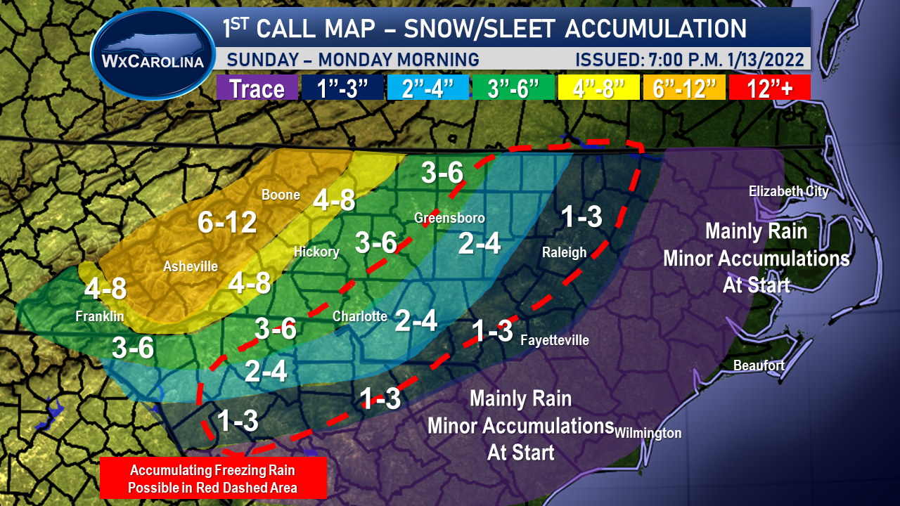
As always, this map may change based on additional data and changes in the forecast. I will be fine tuning the forecast over the next 24-48 hours as we move into the event. As any changes arise, I will keep you updated.
