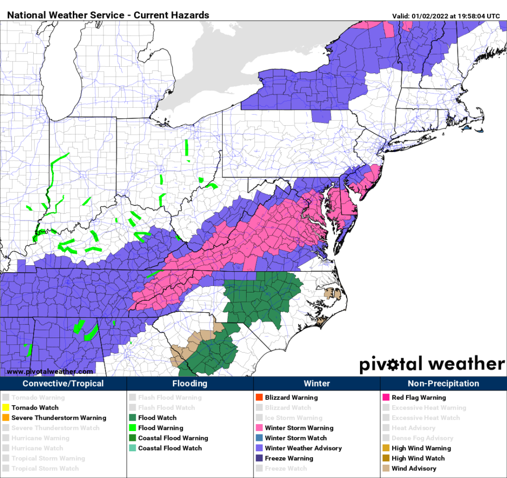
Winter Storm Warnings have been issued for the mountains of NC ahead of a quick moving system that is expected to bring anywhere from 2-6 inches of snow. Outside the mountains, winter weather advisories have been issued for the counties bordering the VA line as the system moves northward and cold air races in behind it.

As of 3:00 p.m. Sunday 1/2/2022, the counties shaded in pink are under a WINTER STORM WARNING and the counties shaded in purple are under a WINTER WEATHER ADVISORY. Counties shaded in green are under FLOOD WATCH due to heavy rain from the system.
Below is the 18z run of the high resolution computer model, and it shows the progression of the system this afternoon through tomorrow afternoon. You can see the moisture surging northward and the low pressure moving towards the coast. As the low hits the coast, notice how the rain changes to snow from west to east.

The wintry part of the system is expected Monday Morning as the cold air rushes in behind the system. The rain is expected to change to snow in the mountains first where 2-6 inches of snow is expected. The higher amounts are expected in the peaks, while lower amounts are expected in the valleys.
Outside the mountains, the cold air will be chasing the moisture. The best chance to see a quick accumulation are the counties along the VA border Monday morning. That is where a winter weather advisory has been issued. Elsewhere, accumulations are not expected due to warm ground temperatures and the quick moving nature of the system. Flurries and a quick dusting can not be ruled out.
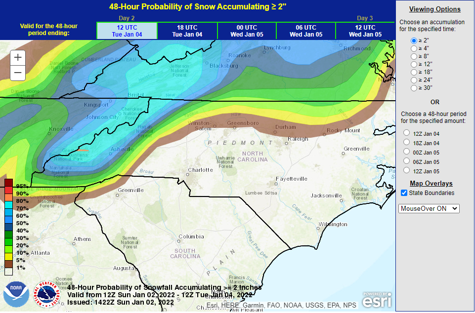
The NWS map below shows the chance of receiving 2 or more inches of snow is greatest in the mountains, with a lower chance as you approach the NC/VA border counties.

Not only is there a threat of snow, but also heavy rain could lead to flooding concerns, especially in central NC. An additional 1-2 inches of rain is expected across the Carolinas, with isolated higher amounts. Be sure to remember to turn around if you see water covering the roads.
